|
search place name
|
||
Sarači (Croatia)Sarači is a town in Croatia. An overview map of the region around Sarači is displayed below.
regional and 3d topo map of Sarači, Croatia ::

Sarači airports ::
The nearest airport is SPU - Split, located 35.7 km west of Sarači.
Other airports nearby include OMO - Mostar (96.8 km east), ZAD - Zadar (124.9 km north west), SJJ - Sarajevo (131.4 km east), DBV - Dubrovnik (170.1 km south east), Nearby towns ::
Čaporice (0.4km south) //
Čovići (0.5km north) //
Živaljići (0.6km south west) //
Nevoljići (0.9km south east) //
Klarići (1.1km south) //
Roguljići (1.3km north) //
Bravići (1.3km north) //
Živaljići (1.4km west) //
Ispod Crkve (1.7km north west) //
Mladina (1.5km east) //
Šušnjare (1.8km north east) //
Gardun (1.8km north west) //
Golinjevo (1.7km north west) //
Trilj (2.3km north) //
Cvitanovići (1.9km north east) //
Kutleše (2.4km south) //
Vuco (1.9km north west) //
Vukadini (2.5km south) //
Bašići (2.2km north west) //
Pavela (2.3km south east) //
Mamut (2.0km west) //
Mudnići (3.0km south) //
Vedrine (2.9km north) //
Ugljane (3.1km south) //
Šipići (3.1km north) //
Krolo (2.4km east) //
Gubavica (3.4km north) //
Rakičani (2.6km west) //
Marasovići (2.6km east) //
[all distances 'as the bird flies' and approximate] 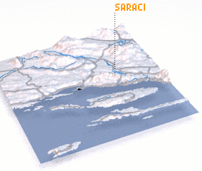 Places with similar names to Sarači, Croatia ::
Disclaimer :: Information on this page comes without warranty of any kind |
||
|
Where is Sarači? Elevation and coordinates ::
Latitude (lat): 43°35'55"N Longitude (lon): 16°43'54"E
Elevation (approx.): 434m (map arrows pan, magnifying glasses zoom) |
||
|
Visiting Sarači? Hotel/Accommodation ::
Book a hotel in Sarači Travel Guide ::
Buy a travel guide for Croatia rental cars ::
car rental offers GPS waypoint ::
download a GPX waypoint (PoI) of Sarači for your GPS receiver
|
||