|
search place name
|
||
Skendžići (Croatia)Skendžići is a town in Croatia. An overview map of the region around Skendžići is displayed below.
regional and 3d topo map of Skendžići, Croatia ::

Skendžići airports ::
The nearest airport is RJK - Rijeka, located 59.9 km north west of Skendžići.
Other airports nearby include ZAD - Zadar (86.9 km south), PUY - Pula (98.0 km west), ZAG - Zagreb (119.4 km north east), POW - Portoroz (138.4 km north west), Nearby towns ::
Ivančevići (1.1km south west) //
(( Mlada Nedelja )) (1.2km south west) //
Švica (1.3km south east) //
Burić Klanac (1.4km east) //
Gerovo Selo (2.1km south east) //
(( Gornja Švica )) (1.7km east) //
Gornje Selo (2.2km north east) //
Buk (2.0km south west) //
(( Donja Švica )) (2.2km south east) //
Ponori (2.0km south west) //
Bjeljevine (2.3km north west) //
Podkraj (2.9km north) //
Diklići (2.2km west) //
Rožići (2.9km north) //
Banjani (2.4km west) //
Orovac (2.6km east) //
Gorići (3.3km south west) //
Oreškovići (3.8km north) //
Srpsko Polje (3.5km north west) //
Šimunići (3.9km north west) //
Bartulci (4.0km south east) //
Kompolje (4.3km north) //
Grozdanići (3.3km south west) //
Vugliši (3.5km south west) //
Rostrun (3.4km west) //
Vardići (4.1km north west) //
Šumećica (3.8km south east) //
Jurkovići (4.8km north) //
Rukavine (4.2km north west) //
[all distances 'as the bird flies' and approximate] 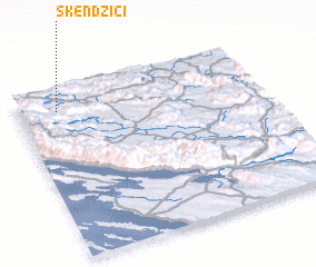 Places with similar names to Skendžići, Croatia ::
// Skendžići (HR)
Disclaimer :: Information on this page comes without warranty of any kind |
||
|
Where is Skendžići? Elevation and coordinates ::
Latitude (lat): 44°52'45"N Longitude (lon): 15°9'45"E
Elevation (approx.): 483m (map arrows pan, magnifying glasses zoom) |
||
|
Visiting Skendžići? Hotel/Accommodation ::
Book a hotel in Skendžići Travel Guide ::
Buy a travel guide for Croatia rental cars ::
car rental offers GPS waypoint ::
download a GPX waypoint (PoI) of Skendžići for your GPS receiver
|
||