|
search place name
|
||
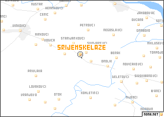
Srijemske Laze (Croatia)Srijemske Laze is a town in Croatia. An overview map of the region around Srijemske Laze is displayed below.
regional and 3d topo map of Srijemske Laze, Croatia ::
Srijemske Laze airports ::
The nearest airport is OSI - Osijek, located 27.5 km north of Srijemske Laze.
Other airports nearby include BEG - Beograd (117.8 km east), SJJ - Sarajevo (163.4 km south), OMO - Mostar (233.1 km south), Nearby towns ::
(( Pustara Laze )) (1.5km north east) //
Slakovci (1.6km south east) //
Stari Jankovci (3.7km north) //
Novi Jankovci (3.0km west) //
Svinjarevci (3.5km north east) //
Orolik (4.5km east) //
Petrovci (6.6km north) //
Vodica (5.9km north west) //
Berak (5.5km east) //
Negoslavci (7.4km north east) //
[all distances 'as the bird flies' and approximate] 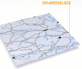 Places with similar names to Srijemske Laze, Croatia :: Disclaimer :: Information on this page comes without warranty of any kind |
||
|
Where is Srijemske Laze? Elevation and coordinates ::
Latitude (lat): 45°13'50"N Longitude (lon): 18°55'55"E
Elevation (approx.): 93m (map arrows pan, magnifying glasses zoom) |
||
|
Visiting Srijemske Laze? Hotel/Accommodation ::
Book a hotel in Srijemske Laze Travel Guide ::
Buy a travel guide for Croatia rental cars ::
car rental offers GPS waypoint ::
download a GPX waypoint (PoI) of Srijemske Laze for your GPS receiver
|
||