|
search place name
|
||
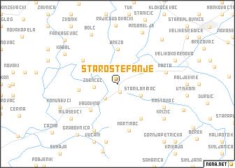
Staro Štefanje (Croatia)Staro Štefanje is a town in Croatia. An overview map of the region around Staro Štefanje is displayed below.
regional and 3d topo map of Staro Štefanje, Croatia ::
Staro Štefanje airports ::
The nearest airport is ZAG - Zagreb, located 51.0 km west of Staro Štefanje.
Other airports nearby include MBX - Maribor (108.5 km north west), GRZ - Graz (163.4 km north west), ZAD - Zadar (218.5 km south west), SJJ - Sarajevo (255.6 km south east), Nearby towns ::
Štefanje (1.4km south) //
Daskatica (2.7km south west) //
Zdenčec (2.7km west) //
Blatnica (3.2km north east) //
Stari Laminac (3.2km south east) //
Breza (5.6km north) //
Vagovina (5.1km south west) //
Sišćani (4.4km west) //
Gornja Šušnjara (6.1km south east) //
Donja Ššnjara (6.1km south east) //
Donji Markovac (5.4km north west) //
Martinac (7.5km south) //
Narta (5.7km east) //
Rastovac (6.4km south east) //
Bojana (7.9km south) //
Bolč (8.4km north) //
Prgomelje (8.7km north) //
Križić (7.6km south east) //
Milaševci (7.6km south west) //
Kabal (7.6km north west) //
Gudovac (8.6km north east) //
Grabovnica (9.2km south west) //
Farkaševac (9.1km north west) //
[all distances 'as the bird flies' and approximate]  Places with similar names to Staro Štefanje, Croatia :: Disclaimer :: Information on this page comes without warranty of any kind |
||
|
Where is Staro Štefanje? Elevation and coordinates ::
Latitude (lat): 45°49'0"N Longitude (lon): 16°43'0"E
Elevation (approx.): 146m (map arrows pan, magnifying glasses zoom) |
||
|
Visiting Staro Štefanje? Hotel/Accommodation ::
Book a hotel in Staro Štefanje Travel Guide ::
Buy a travel guide for Croatia rental cars ::
car rental offers GPS waypoint ::
download a GPX waypoint (PoI) of Staro Štefanje for your GPS receiver
|
||