|
search place name
|
||
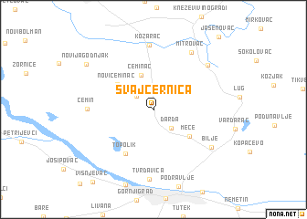
Švajcernica (Croatia)Švajcernica is a town in Croatia. An overview map of the region around Švajcernica is displayed below.
regional and 3d topo map of Švajcernica, Croatia ::
Švajcernica airports ::
The nearest airport is OSI - Osijek, located 23.0 km south east of Švajcernica.
Other airports nearby include BEG - Beograd (157.7 km south east), BUD - Budapest Ferihegy (203.6 km north), SJJ - Sarajevo (204.6 km south), Nearby towns ::
Uglješ (2.1km north west) //
Darda (2.7km south east) //
Čeminac (4.3km north) //
Novi Čeminac (4.3km north west) //
Mece (4.5km south east) //
Topolik (5.9km south west) //
Kozarac (7.9km north) //
Čemin (5.7km west) //
Mitrovac (7.7km north east) //
Bilje (6.8km south east) //
Grabovac (7.1km north east) //
Tvrđavica (8.6km south) //
Novi Jagodnjak (7.9km north west) //
Višnjevac (10.3km south west) //
Jasenovac (10.5km north east) //
[all distances 'as the bird flies' and approximate] 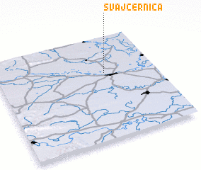 Places with similar names to Švajcernica, Croatia :: Disclaimer :: Information on this page comes without warranty of any kind |
||
|
Where is Švajcernica? Elevation and coordinates ::
Latitude (lat): 45°38'55"N Longitude (lon): 18°40'50"E
Elevation (approx.): 86m (map arrows pan, magnifying glasses zoom) |
||
|
Visiting Švajcernica? Hotel/Accommodation ::
Book a hotel in Švajcernica Travel Guide ::
Buy a travel guide for Croatia rental cars ::
car rental offers GPS waypoint ::
download a GPX waypoint (PoI) of Švajcernica for your GPS receiver
|
||