|
search place name
|
||
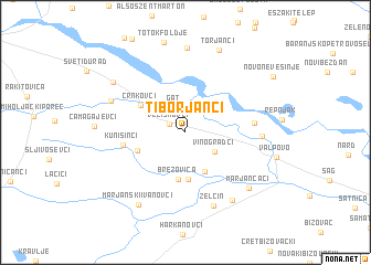
Tiborjanci (Croatia)Tiborjanci is a town in Croatia. An overview map of the region around Tiborjanci is displayed below.
regional and 3d topo map of Tiborjanci, Croatia ::
Tiborjanci airports ::
The nearest airport is OSI - Osijek, located 44.4 km south east of Tiborjanci.
Other airports nearby include BEG - Beograd (182.3 km south east), SJJ - Sarajevo (206.6 km south), BUD - Budapest Ferihegy (207.3 km north), Nearby towns ::
Veliškovci (1.4km north west) //
Gat (2.7km north) //
Vinogradci (2.8km south east) //
Gorica Valpovačka (4.2km south) //
Bocanjevci (4.7km south) //
Brezovica (4.8km south) //
Marjanci (3.8km south west) //
Črnkovci (4.2km north west) //
Kunišinci (4.6km west) //
Bistrinci (5.0km east) //
Belišće (5.4km east) //
Zelčin (7.7km south) //
Bočkinci (6.1km north west) //
Ivanovci (7.6km south east) //
Marjančaci (7.2km south east) //
Eperjespuszta (8.6km north) //
Marjanski Ivanovci (8.0km south west) //
Podgajci Podravski (7.2km north west) //
Torjanci (8.7km north) //
Novo Nevesinje (8.4km north east) //
[all distances 'as the bird flies' and approximate] 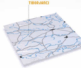 Places with similar names to Tiborjanci, Croatia ::
// Dobrejance (CS)
Disclaimer :: Information on this page comes without warranty of any kind |
||
|
Where is Tiborjanci? Elevation and coordinates ::
Latitude (lat): 45°41'0"N Longitude (lon): 18°20'9"E
Elevation (approx.): 92m (map arrows pan, magnifying glasses zoom) |
||
|
Visiting Tiborjanci? Hotel/Accommodation ::
Book a hotel in Tiborjanci Travel Guide ::
Buy a travel guide for Croatia rental cars ::
car rental offers GPS waypoint ::
download a GPX waypoint (PoI) of Tiborjanci for your GPS receiver
|
||