|
search place name
|
||
Trnakovac (Brodsko-Posavska Županija, Croatia)Trnakovac is a town in the Brodsko-Posavska Županija region of Croatia. An overview map of the region around Trnakovac is displayed below.
regional and 3d topo map of Trnakovac, Croatia ::

Trnakovac airports ::
The nearest airport is ZAG - Zagreb, located 100.2 km north west of Trnakovac.
Other airports nearby include OSI - Osijek (126.7 km east), MBX - Maribor (174.3 km north west), SJJ - Sarajevo (189.1 km south east), ZAD - Zadar (199.7 km south west), Nearby towns ::
Čaprginci (1.3km south east) //
Benkovac Okučanski (1.7km south) //
Bijela Stijena (2.9km north) //
Cage (3.7km south) //
Milisavci (3.1km west) //
Donji Rogolji (4.1km north) //
Gornji Čaglić (4.8km north) //
Bjelanovac (4.4km north west) //
Gornje Rogolje (4.9km north) //
Širinci (4.0km east) //
Rajčići (4.3km west) //
Bukovčani (6.6km north) //
Lađevac (6.3km south west) //
Bodegraji (6.6km south) //
Okučani (7.3km south) //
Borovac (5.9km south west) //
Smrtić (6.3km south east) //
Gornji Bogičevci (7.6km south) //
Donji Rajić (6.1km south west) //
Donji Čaglić (7.7km north west) //
Donji Okučani (8.5km south) //
Vrbovljani (8.9km south) //
[all distances 'as the bird flies' and approximate] 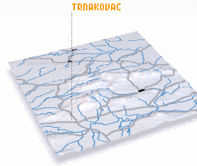 Places with similar names to Trnakovac, Croatia :: Disclaimer :: Information on this page comes without warranty of any kind |
||
|
Where is Trnakovac? Elevation and coordinates ::
Latitude (lat): 45°19'26"N Longitude (lon): 17°12'14"E
Elevation (approx.): 184m (map arrows pan, magnifying glasses zoom) |
||
|
Visiting Trnakovac? Hotel/Accommodation ::
Book a hotel in Trnakovac Travel Guide ::
Buy a travel guide for Croatia rental cars ::
car rental offers GPS waypoint ::
download a GPX waypoint (PoI) of Trnakovac for your GPS receiver
|
||