|
search place name
|
||
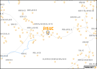
Visuć (Croatia)Visuć is a town in Croatia. An overview map of the region around Visuć is displayed below.
regional and 3d topo map of Visuć, Croatia ::
Visuć airports ::
The nearest airport is ZAD - Zadar, located 60.4 km south west of Visuć.
Other airports nearby include SPU - Split (116.2 km south), RJK - Rijeka (125.4 km north west), ZAG - Zagreb (136.4 km north), PUY - Pula (156.4 km west), Nearby towns ::
Kumazečeva Draga (0.4km west) //
Potkraj (0.8km south) //
Kosanović Gaj (0.7km east) //
Kesići (1.3km north east) //
Šarić Brdo (1.6km north west) //
Veljun (1.7km south west) //
Selište (2.5km north) //
Potkrčana (2.4km south west) //
Tišmin Varoš (2.3km north west) //
Vrišti (2.0km west) //
Vijenac (2.3km east) //
Kranjsko Selište (3.4km north) //
Podkuk (2.9km south east) //
Podmetlom (3.0km east) //
Bukovac (3.2km west) //
Trnava Poljana (3.7km east) //
Bjelobabe (4.2km south west) //
Kneževići (4.3km west) //
Mutilić (4.3km west) //
Kraljevac (4.6km west) //
Ajdukovići (4.8km south west) //
Galovići (5.3km south west) //
Ondić (5.3km south west) //
Udbina (4.9km west) //
Stanići (5.1km west) //
Gečet (5.2km west) //
Vrba (5.1km west) //
Stojići (5.9km north west) //
Podjasle (5.2km east) //
[all distances 'as the bird flies' and approximate]  Places with similar names to Visuć, Croatia ::
Disclaimer :: Information on this page comes without warranty of any kind |
||
|
Where is Visuć? Elevation and coordinates ::
Latitude (lat): 44°31'40"N Longitude (lon): 15°49'39"E
Elevation (approx.): 795m (map arrows pan, magnifying glasses zoom) |
||
|
Visiting Visuć? Hotel/Accommodation ::
Book a hotel in Visuć Travel Guide ::
Buy a travel guide for Croatia rental cars ::
car rental offers GPS waypoint ::
download a GPX waypoint (PoI) of Visuć for your GPS receiver
|
||