|
search place name
|
||
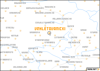
Vrh Letovanićki (Croatia)Vrh Letovanićki is a town in Croatia. An overview map of the region around Vrh Letovanićki is displayed below.
regional and 3d topo map of Vrh Letovanićki, Croatia ::
Vrh Letovanićki airports ::
The nearest airport is ZAG - Zagreb, located 26.3 km north of Vrh Letovanićki.
Other airports nearby include MBX - Maribor (113.3 km north), RJK - Rijeka (129.4 km west), LJU - Ljubliana Ljubljana (154.2 km north west), ZAD - Zadar (169.4 km south west), Nearby towns ::
Selišće Letovaničko (1.3km east) //
Palanjek Pokupski (2.6km west) //
Stari Brod (3.7km south) //
Stari Farkašić (3.4km south west) //
Cerje Letovaničko (3.9km north) //
Letovanić (3.2km south east) //
Novi Farkašić (3.9km south) //
Dumače (4.9km south) //
Nebojan (4.8km south east) //
Srebrenik (3.9km west) //
Poljana Lekenička (6.1km north east) //
Brežane Lekeničke (7.5km north) //
Slana (7.9km south) //
Dužica (6.1km north east) //
Vratečko (7.3km south west) //
Lekenik (8.4km north east) //
Brkiševina (10.1km south west) //
[all distances 'as the bird flies' and approximate] 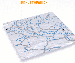 Places with similar names to Vrh Letovanićki, Croatia :: Disclaimer :: Information on this page comes without warranty of any kind |
||
|
Where is Vrh Letovanićki? Elevation and coordinates ::
Latitude (lat): 45°31'0"N Longitude (lon): 16°10'0"E
Elevation (approx.): 152m (map arrows pan, magnifying glasses zoom) |
||
|
Visiting Vrh Letovanićki? Hotel/Accommodation ::
Book a hotel in Vrh Letovanićki Travel Guide ::
Buy a travel guide for Croatia rental cars ::
car rental offers GPS waypoint ::
download a GPX waypoint (PoI) of Vrh Letovanićki for your GPS receiver
|
||