|
search place name
|
||
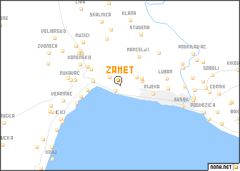
Zamet (Primorsko-Goranska Županija, Croatia)Zamet is a town in the Primorsko-Goranska Županija region of Croatia. An overview map of the region around Zamet is displayed below.
regional and 3d topo map of Zamet, Croatia ::
Zamet airports ::
The nearest airport is RJK - Rijeka, located 22.4 km south east of Zamet.
Other airports nearby include POW - Portoroz (60.0 km west), PUY - Pula (61.9 km south west), TRS - Ronchi De Legionari Ronchi Dei Legionari (87.1 km north west), LJU - Ljubliana Ljubljana (96.8 km north), Nearby towns ::
Turan (1.0km south west) //
Rubeši (1.8km north west) //
Kastav (2.5km north west) //
Bezjaki (2.3km north east) //
(( Hosti )) (2.6km east) //
Marinići (2.7km north east) //
Matulji (3.0km west) //
Volosko (3.6km west) //
Jušići (4.1km north west) //
Rijeka (3.9km east) //
Marčelji (5.0km north east) //
Jurdani (4.6km north west) //
Opatija (4.6km west) //
Korensko (5.4km north west) //
Donji Rukavac (5.0km west) //
(( Slatina )) (5.5km south west) //
(( Luban )) (5.3km east) //
Drenova (5.3km east) //
Rukavac (5.4km west) //
Breza (7.5km north) //
Kukuljani (6.6km north east) //
Mučići (6.6km north west) //
Gornji Rukavac (5.8km west) //
Varljeni (6.9km north west) //
Puži (6.8km north west) //
Studena (8.3km north) //
(( Velika Lešnica )) (8.8km north) //
Ružići (7.8km north west) //
Veprinac (6.7km west) //
[all distances 'as the bird flies' and approximate] 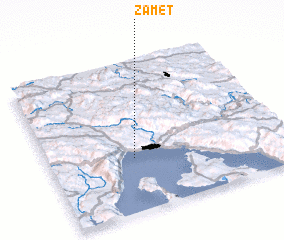 Places with similar names to Zamet, Croatia ::
Disclaimer :: Information on this page comes without warranty of any kind |
||
|
Where is Zamet? Elevation and coordinates ::
Latitude (lat): 45°21'18"N Longitude (lon): 14°21'46"E
Elevation (approx.): 199m (map arrows pan, magnifying glasses zoom) |
||
|
Visiting Zamet? Hotel/Accommodation ::
Book a hotel in Zamet Travel Guide ::
Buy a travel guide for Croatia rental cars ::
car rental offers GPS waypoint ::
download a GPX waypoint (PoI) of Zamet for your GPS receiver
|
||