|
search place name
|
||
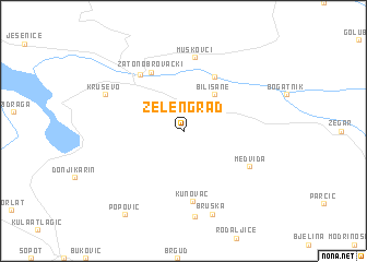
Zelengrad (Croatia)Zelengrad is a town in Croatia. An overview map of the region around Zelengrad is displayed below.
regional and 3d topo map of Zelengrad, Croatia ::
Zelengrad airports ::
The nearest airport is ZAD - Zadar, located 30.4 km west of Zelengrad.
Other airports nearby include SPU - Split (82.2 km south east), RJK - Rijeka (149.7 km north west), PUY - Pula (165.2 km north west), ZAG - Zagreb (179.1 km north), Nearby towns ::
Bilišane (4.3km north east) //
Bilišane Donje (6.0km north) //
Zaton Obrovački (6.4km north) //
Obrovac (6.5km north west) //
Kunovac (7.2km south) //
Muškovci (7.5km north) //
Medviđa (6.1km south east) //
Kruševo (6.9km north west) //
Bruška (8.7km south) //
Gornji Karin (8.9km south) //
Popović (9.5km south west) //
[all distances 'as the bird flies' and approximate] 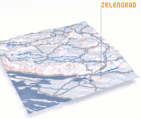 Places with similar names to Zelengrad, Croatia ::
// Zelënyy Gorod (RU)
// Zelenigrad (BG)
// Zelengrad (MK)
// Zelënyy Gorod (RU)
// Selaincourt (FR)
// Seloncourt (FR)
// Zelenograd (RU)
// Selincourt (FR)
// Soulaincourt (FR)
Disclaimer :: Information on this page comes without warranty of any kind |
||
|
Where is Zelengrad? Elevation and coordinates ::
Latitude (lat): 44°9'0"N Longitude (lon): 15°43'20"E
Elevation (approx.): 385m (map arrows pan, magnifying glasses zoom) |
||
|
Visiting Zelengrad? Hotel/Accommodation ::
Book a hotel in Zelengrad Travel Guide ::
Buy a travel guide for Croatia rental cars ::
car rental offers GPS waypoint ::
download a GPX waypoint (PoI) of Zelengrad for your GPS receiver
|
||