|
search place name
|
||
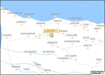
Kambyli (Cyprus)Kambyli is a town in Cyprus. An overview map of the region around Kambyli is displayed below.
regional and 3d topo map of Kambyli, Cyprus ::
Kambyli airports ::
The nearest airport is LCA - Larnaca, located 66.6 km south east of Kambyli.
Other airports nearby include AKT - Akrotiri (79.5 km south), PFO - Paphos Pafos Intl (86.0 km south west), Nearby towns ::
Panayia (1.8km north west) //
Asomatos (2.8km south) //
Kondemenos (3.6km south east) //
Larnaka (3.3km north east) //
Karpasha (3.8km west) //
Myrtou (3.9km west) //
Agridhaki (3.9km east) //
Vasilia (5.3km north) //
Panagra (5.4km north west) //
Dhiorios (4.9km west) //
Dhyo Potami (6.1km south) //
Sisklipos (5.7km east) //
Ayios Ermolaos (6.1km east) //
Vavilas (7.5km north) //
Vokolomandia (7.2km west) //
Lapithos (7.7km north east) //
Ayia Marina (8.9km south) //
Skylloura (9.1km south east) //
Kalokhorio (8.8km south west) //
Ayia Varvara (9.1km north east) //
Orga (9.7km north west) //
Yerondas (10.1km north west) //
Ayios Vasilios (10.4km south east) //
[all distances 'as the bird flies' and approximate] 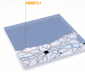 Places with similar names to Kambyli, Cyprus ::
Disclaimer :: Information on this page comes without warranty of any kind |
||
|
Where is Kambyli? Elevation and coordinates ::
Latitude (lat): 35°18'0"N Longitude (lon): 33°6'30"E
Elevation (approx.): 255m (map arrows pan, magnifying glasses zoom) |
||
|
Visiting Kambyli? Hotel/Accommodation ::
Book a hotel in Kambyli Travel Guide ::
Buy a travel guide for Cyprus rental cars ::
car rental offers GPS waypoint ::
download a GPX waypoint (PoI) of Kambyli for your GPS receiver
|
||