|
search place name
|
||
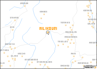
Milikouri (Cyprus)Milikouri is a town in Cyprus. An overview map of the region around Milikouri is displayed below.
regional and 3d topo map of Milikouri, Cyprus ::
Milikouri airports ::
The nearest airport is PFO - Paphos Pafos Intl, located 36.7 km south west of Milikouri.
Other airports nearby include AKT - Akrotiri (47.1 km south east), LCA - Larnaca (80.6 km east), AYT - Antalya (277.3 km north west), Nearby towns ::
Kaminaria (5.2km south east) //
Tris Elies (5.9km south east) //
Chakistra (6.8km north) //
Yerakies (6.5km north east) //
Lemithou (6.4km east) //
Kambos (8.1km north) //
Ayios Dhimitrios (7.6km south east) //
Kalopanayiotis (7.4km east) //
Pedhoulas (7.2km east) //
Paleomylos (7.6km south east) //
Moutoullas (7.4km east) //
Prodhromos (7.4km east) //
[all distances 'as the bird flies' and approximate]  Places with similar names to Milikouri, Cyprus ::
// Mala Gora (AT)
// Malcorai (ET)
// Mühlacker (DE)
// Melgara (PA)
// Malkara (TR)
// Malacuera (ES)
// Milagro (ES)
// Mullā Qarah (IQ)
// Malyye Gari (RU)
// Malyye Gari (RU)
Disclaimer :: Information on this page comes without warranty of any kind |
||
|
Where is Milikouri? Elevation and coordinates ::
Latitude (lat): 34°58'0"N Longitude (lon): 32°45'0"E
Elevation (approx.): 875m (map arrows pan, magnifying glasses zoom) |
||
|
Visiting Milikouri? Hotel/Accommodation ::
Book a hotel in Milikouri Travel Guide ::
Buy a travel guide for Cyprus rental cars ::
car rental offers GPS waypoint ::
download a GPX waypoint (PoI) of Milikouri for your GPS receiver
|
||