|
search place name
|
||
Algans (Midi-Pyrénées, France)Algans is a town in the Midi-Pyrénées region of France. An overview map of the region around Algans is displayed below.
regional and 3d topo map of Algans, France ::

Algans airports ::
The nearest airport is DCM - Castres Mazamet, located 33.1 km east of Algans.
Other airports nearby include LBI - Albi Le Sequestre (39.5 km north east), TLS - Toulouse Blagnac (42.1 km west), LRH - La Rochelle Lherm (52.9 km west), CCF - Carcassonne Salvaza (54.7 km south east), Nearby towns ::
Cambon (2.3km south west) //
Roquevidal (3.9km north) //
Magrin (4.6km north east) //
Cuq-Toulza (5.6km south) //
Pratviel (5.7km north) //
Lacroisille (4.4km south east) //
Veilhes (4.4km north west) //
Le Faget (5.5km south west) //
Maurens-Scopont (5.4km west) //
Bertre (5.4km east) //
Mouzens (7.5km south) //
Teyssode (6.9km north east) //
La Cougotte-Cadoul (6.9km north west) //
Massac-Séran (7.9km north) //
Aguts (7.9km south) //
Marzens (8.4km north west) //
Péchaudier (9.2km south east) //
[all distances 'as the bird flies' and approximate] 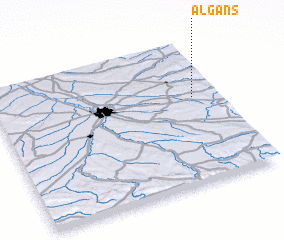 Places with similar names to Algans, France ::
// Alcains (PT)
// Al Kunayyisah (EG)
// Al Kunayyisah (EG)
// Alcañiz (ES)
// Alcañizo (ES)
// Alcuneza (ES)
// Alakince (MK)
// Alaquines (MX)
// Al Kanīsah (SD)
// Al Kunayzah (SD)
Disclaimer :: Information on this page comes without warranty of any kind |
||
|
Where is Algans? Elevation and coordinates ::
Latitude (lat): 43°36'0"N Longitude (lon): 1°53'0"E
Elevation (approx.): 229m (map arrows pan, magnifying glasses zoom) |
||
|
Visiting Algans? Hotel/Accommodation ::
Book a hotel in Algans Travel Guide ::
Buy a travel guide for France rental cars ::
car rental offers GPS waypoint ::
download a GPX waypoint (PoI) of Algans for your GPS receiver
|
||