|
search place name
|
||
Andechy (Picardie, France)Andechy is a town in the Picardie region of France. An overview map of the region around Andechy is displayed below.
regional and 3d topo map of Andechy, France ::

Andechy airports ::
The nearest airport is BVA - Beauvais Tille, located 52.5 km south west of Andechy.
Other airports nearby include CSF - Creil (53.5 km south), CDG - Paris Charles De Gaulle (79.2 km south), POX - Pontoise Cormeilles En Vexin (84.6 km south west), LBG - Paris Le Bourget (85.5 km south), Nearby towns ::
LʼÉchelle-Saint-Aurin (1.9km south) //
Villers-lès-Roye (2.2km south east) //
Armancourt (3.7km south) //
Damery (3.0km north east) //
Le Quesnoy-en-Santerre (3.9km north) //
Parvillers (4.4km north east) //
Bouchoir (4.4km north west) //
Goyencourt (3.6km east) //
Rouvroy-en-Santerre (5.6km north) //
Dancourt (5.7km south) //
Marquivillers (5.7km south) //
Guerbigny (4.0km south west) //
La Chavatte (5.2km north east) //
Folies (5.2km north west) //
Fouquescourt (6.1km north east) //
Laboissière-en-Santerre (6.1km south west) //
Saint-Mard (5.2km south east) //
Warvillers (6.1km north west) //
Fresnoy-lès-Roye (5.1km east) //
Grivillers (7.5km south) //
Popincourt (7.5km south) //
Arvillers (5.1km west) //
Warsy (5.1km west) //
Laucourt (6.6km south east) //
Fransart (6.6km north east) //
Beaufort-en-Santerre (6.6km north west) //
Maucourt (7.8km north) //
Vrély (7.8km north) //
Lignières-les-Roye (6.1km south west) //
[all distances 'as the bird flies' and approximate] 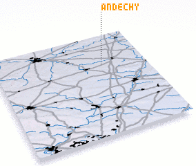 Places with similar names to Andechy, France ::
Disclaimer :: Information on this page comes without warranty of any kind |
||
|
Where is Andechy? Elevation and coordinates ::
Latitude (lat): 49°43'0"N Longitude (lon): 2°43'0"E
Elevation (approx.): 91m (map arrows pan, magnifying glasses zoom) |
||
|
Visiting Andechy? Hotel/Accommodation ::
Book a hotel in Andechy Travel Guide ::
Buy a travel guide for France rental cars ::
car rental offers GPS waypoint ::
download a GPX waypoint (PoI) of Andechy for your GPS receiver
|
||