|
search place name
|
||
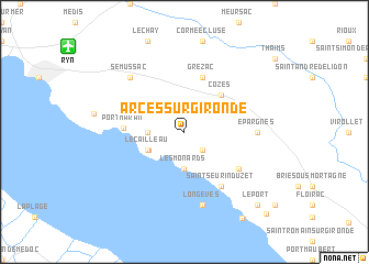
Arces-sur-Gironde (Poitou-Charentes, France)Arces-sur-Gironde is a town in the Poitou-Charentes region of France. An overview map of the region around Arces-sur-Gironde is displayed below.
regional and 3d topo map of Arces-sur-Gironde, France ::
Arces-sur-Gironde airports ::
The nearest airport is RYN - Royan Medis, located 12.0 km north west of Arces-sur-Gironde.
Other airports nearby include RCO - Rochefort St Agnant (38.6 km north), CNG - Cognac Chateaubernard (44.5 km east), BOD - Bordeaux Merignac (81.1 km south), ANG - Angouleme Brie Champniers (87.1 km east), Nearby towns ::
Barzan (2.3km south east) //
Les Monards (3.7km south) //
Saint-Martin-des-Fontaines (2.6km west) //
Le Caiflaud (3.1km south west) //
Le Cailleau (3.2km south west) //
Talmont (3.2km south west) //
Cozes (4.5km north east) //
Grézac (5.7km north) //
Port-Maran (4.3km west) //
Chenac-sur-Gironde (5.4km south east) //
Saint-Seurin-dʼUzet (6.1km south east) //
Épargnes (5.2km east) //
Longèves (7.5km south) //
Sémussac (6.8km north west) //
Le Port (9.1km south east) //
Mortagne (9.7km south east) //
La Rive (10.2km south east) //
[all distances 'as the bird flies' and approximate] 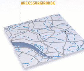 Places with similar names to Arces-sur-Gironde, France :: Disclaimer :: Information on this page comes without warranty of any kind |
||
|
Where is Arces-sur-Gironde? Elevation and coordinates ::
Latitude (lat): 45°33'0"N Longitude (lon): 0°52'0"W
Elevation (approx.): 25m (map arrows pan, magnifying glasses zoom) |
||
|
Visiting Arces-sur-Gironde? Hotel/Accommodation ::
Book a hotel in Arces-sur-Gironde Travel Guide ::
Buy a travel guide for France rental cars ::
car rental offers GPS waypoint ::
download a GPX waypoint (PoI) of Arces-sur-Gironde for your GPS receiver
|
||