|
search place name
|
||
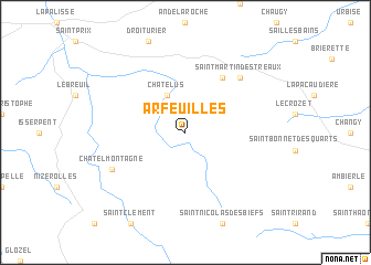
Arfeuilles (Auvergne, France)Arfeuilles is a town in the Auvergne region of France. An overview map of the region around Arfeuilles is displayed below.
regional and 3d topo map of Arfeuilles, France ::
Arfeuilles airports ::
The nearest airport is RNE - Roanne Renaison, located 21.9 km south east of Arfeuilles.
Other airports nearby include VHY - Vichy Charmeil (26.8 km west), XMU - Moulins Montbeugny (49.6 km north west), CFE - Clermont Ferrand Auvergne (60.5 km south west), XVF - Vilefrance Tarare (73.9 km east), Nearby towns ::
Châtelus (3.9km north) //
Saint-Pierre-Laval (6.1km north east) //
Saint-Martin-dʼEstréaux (6.8km north east) //
Châtel-Montagne (6.3km south west) //
[all distances 'as the bird flies' and approximate] 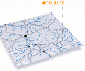 Places with similar names to Arfeuilles, France ::
Disclaimer :: Information on this page comes without warranty of any kind |
||
|
Where is Arfeuilles? Elevation and coordinates ::
Latitude (lat): 46°9'0"N Longitude (lon): 3°45'0"E
Elevation (approx.): 697m (map arrows pan, magnifying glasses zoom) |
||
|
Visiting Arfeuilles? Hotel/Accommodation ::
Book a hotel in Arfeuilles Travel Guide ::
Buy a travel guide for France rental cars ::
car rental offers GPS waypoint ::
download a GPX waypoint (PoI) of Arfeuilles for your GPS receiver
|
||