|
search place name
|
||
Arnancourt (Champagne-Ardenne, France)Arnancourt is a town in the Champagne-Ardenne region of France. An overview map of the region around Arnancourt is displayed below.
regional and 3d topo map of Arnancourt, France ::

Arnancourt airports ::
The nearest airport is QYR - Troyes Barberey, located 66.8 km west of Arnancourt.
Other airports nearby include EPL - Epinal Mirecourt (85.5 km east), ENC - Nancy Essey (104.2 km east), AUF - Auxerre Branches (119.4 km south west), MZM - Metz Frescaty (120.1 km north east), Nearby towns ::
Cirey-sur-Blaise (2.2km south east) //
Villiers-aux-Chênes (2.2km north west) //
Doulevant-le-Château (3.7km north) //
Bouzancourt (4.5km south east) //
Dommartin-le-Saint-Père (5.6km north) //
Humbercin (3.7km west) //
Baudrecourt (6.1km north east) //
Daillancourt (6.1km south east) //
Courcelles-sur-Blaise (7.5km north) //
Blumeray (5.3km west) //
Guindrecourt-sur-Blaise (6.7km south east) //
Charmes-la-Grande (6.2km north east) //
Champcourt (7.8km south) //
Mertrud (7.8km north) //
Blaise (8.3km south east) //
Rizaucourt (8.3km south west) //
[all distances 'as the bird flies' and approximate] 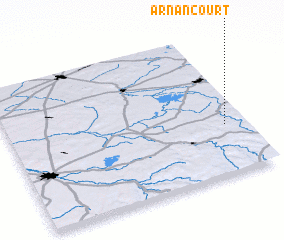 Places with similar names to Arnancourt, France :: Disclaimer :: Information on this page comes without warranty of any kind |
||
|
Where is Arnancourt? Elevation and coordinates ::
Latitude (lat): 48°21'0"N Longitude (lon): 4°55'0"E
Elevation (approx.): 218m (map arrows pan, magnifying glasses zoom) |
||
|
Visiting Arnancourt? Hotel/Accommodation ::
Book a hotel in Arnancourt Travel Guide ::
Buy a travel guide for France rental cars ::
car rental offers GPS waypoint ::
download a GPX waypoint (PoI) of Arnancourt for your GPS receiver
|
||