|
search place name
|
||
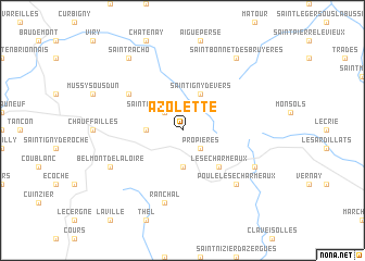
Azolette (Rhône-Alpes, France)Azolette is a town in the Rhône-Alpes region of France. An overview map of the region around Azolette is displayed below.
regional and 3d topo map of Azolette, France ::
Azolette airports ::
The nearest airport is QNX - Macon Charnay, located 31.1 km east of Azolette.
Other airports nearby include RNE - Roanne Renaison (35.7 km south west), XVF - Vilefrance Tarare (37.2 km south east), LYN - Lyon Bron (66.6 km south east), XBK - Bourg Ceyzeriat (67.6 km east), Nearby towns ::
Propières (2.3km south east) //
Saint-Clément-de-Vers (2.3km north west) //
Belleroche (3.7km south) //
Saint-Germain-la-Montagne (2.6km west) //
Saint-Igny-de-Vers (3.9km north) //
Les Écharmeaux (4.5km south east) //
Anglure-sous-Dun (5.3km north west) //
Ranchal (7.5km south) //
Poule-lès-Écharmeaux (6.8km south east) //
Chénelette (6.3km south east) //
Belmont-de-la-Loire (6.3km south west) //
Saint-Bonnet-des-Bruyères (8.4km north east) //
Saint-Racho (8.4km north west) //
[all distances 'as the bird flies' and approximate] 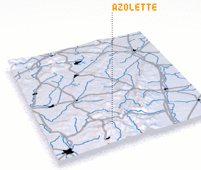 Places with similar names to Azolette, France ::
// Ažuolytė (LT)
// Azelta (US)
// Aslāoda (IN)
// Assolda (IN)
// Asulait (ID)
// Asloût (LB)
// As Salaţah (QA)
// As Salţ (JO)
// Azulita (VE)
// As Sillāţah (SY)
Disclaimer :: Information on this page comes without warranty of any kind |
||
|
Where is Azolette? Elevation and coordinates ::
Latitude (lat): 46°12'0"N Longitude (lon): 4°25'0"E
Elevation (approx.): 568m (map arrows pan, magnifying glasses zoom) |
||
|
Visiting Azolette? Hotel/Accommodation ::
Book a hotel in Azolette Travel Guide ::
Buy a travel guide for France rental cars ::
car rental offers GPS waypoint ::
download a GPX waypoint (PoI) of Azolette for your GPS receiver
|
||