|
search place name
|
||
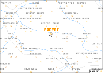
Bagert (Midi-Pyrénées, France)Bagert is a town in the Midi-Pyrénées region of France. An overview map of the region around Bagert is displayed below.
regional and 3d topo map of Bagert, France ::
Bagert airports ::
The nearest airport is LRH - La Rochelle Lherm, located 43.2 km north of Bagert.
Other airports nearby include TLS - Toulouse Blagnac (64.8 km north), LEU - Seo De Urgel (86.9 km south), LDE - Tarbes Lourdes (89.3 km west), CCF - Carcassonne Salvaza (100.6 km east), Nearby towns ::
Bédeille (1.4km east) //
Cérizols (3.9km north) //
Fabas (3.9km north) //
Taurignan-Castet (5.6km south) //
Mercenac (5.6km south) //
Tourtouse (4.1km east) //
Barjac (4.5km south east) //
Sentaraille (5.7km south) //
Caumont (5.7km south) //
Taurignan-Vieux (6.2km south east) //
Betchat (5.7km west) //
Plagne (7.9km north) //
Gajan (8.5km south east) //
Francazal (8.5km south west) //
Prat-et-Bonrepaux (7.8km south west) //
Belbèze-en-Comminges (7.8km north west) //
Ausseing (9.2km north west) //
Montberaud (9.2km north east) //
[all distances 'as the bird flies' and approximate]  Places with similar names to Bagert, France ::
Disclaimer :: Information on this page comes without warranty of any kind |
||
|
Where is Bagert? Elevation and coordinates ::
Latitude (lat): 43°5'0"N Longitude (lon): 1°5'0"E
Elevation (approx.): 444m (map arrows pan, magnifying glasses zoom) |
||
|
Visiting Bagert? Hotel/Accommodation ::
Book a hotel in Bagert Travel Guide ::
Buy a travel guide for France rental cars ::
car rental offers GPS waypoint ::
download a GPX waypoint (PoI) of Bagert for your GPS receiver
|
||