|
search place name
|
||
Baincthun (Nord-Pas-de-Calais, France)Baincthun is a town in the Nord-Pas-de-Calais region of France. An overview map of the region around Baincthun is displayed below.
regional and 3d topo map of Baincthun, France ::

Baincthun airports ::
The nearest airport is LTQ - Le Tourquet Le Touquet Paris Plage, located 22.6 km south of Baincthun.
Other airports nearby include CQF - Calais Dunkerque (33.3 km north east), LYX - Lydd (58.8 km north west), MSE - Manston (73.5 km north), OST - Oostende (98.7 km north east), Nearby towns ::
Huplandre (1.9km north) //
Questinghen (1.9km south) //
Maquinghen (1.2km east) //
LʼErmitage (2.2km north west) //
La Capelle-lès-Boulogne (2.2km north east) //
Fort-Mahon (2.2km south east) //
Souverain-Moulin (3.7km north) //
Coucolette (3.7km south) //
Landacres (3.7km south) //
Echinghen (3.0km south west) //
Pernes-lès-Boulogne (3.9km north) //
Rupembert (4.4km north west) //
Olincthun (4.4km north west) //
Hesdin-lʼAbbé (5.6km south) //
Saint-Martin-Boulogne (3.5km west) //
Pittefaux (5.6km north) //
Maninghen-Henne (5.7km north) //
Brucquedal (5.7km south) //
Hesdres (5.7km north) //
Isques (6.0km south west) //
Conteville-lès-Boulogne (5.1km north east) //
Pont-de-Briques (5.1km south west) //
Boulogne-sur-Mer (4.7km west) //
Offrethun (7.4km north) //
La Madeleine (4.7km west) //
Ville Haute (4.9km west) //
Le Pont Pitendal (4.9km west) //
Wacquinghen (7.5km north) //
Hesdigneul-lès-Boulogne (7.5km south) //
[all distances 'as the bird flies' and approximate] 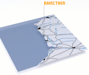 Places with similar names to Baincthun, France ::
// Ban Ao Ko Thon Noi (TH)
// Ban Kathon (TH)
// Ban Kut Hin (TH)
// Ban Kut Hin (TH)
// Ban Kouthin (LA)
// Ban Kouthin (LA)
// Ban Nakathian (LA)
// Ban Ek Thône (VN)
// Bồng Thôn (VN)
// Bổng Thôn (VN)
Disclaimer :: Information on this page comes without warranty of any kind |
||
|
Where is Baincthun? Elevation and coordinates ::
Latitude (lat): 50°43'0"N Longitude (lon): 1°41'0"E
Elevation (approx.): 68m (map arrows pan, magnifying glasses zoom) |
||
|
Visiting Baincthun? Hotel/Accommodation ::
Book a hotel in Baincthun Travel Guide ::
Buy a travel guide for France rental cars ::
car rental offers GPS waypoint ::
download a GPX waypoint (PoI) of Baincthun for your GPS receiver
|
||