|
search place name
|
||
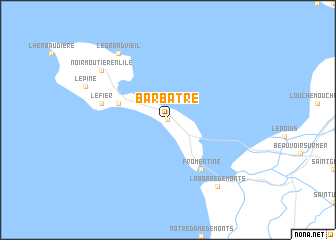
Barbâtre (Pays de la Loire, France)Barbâtre is a town in the Pays de la Loire region of France. An overview map of the region around Barbâtre is displayed below.
regional and 3d topo map of Barbâtre, France ::
Barbâtre airports ::
The nearest airport is SNR - St.-nazaire Montoir, located 40.3 km north of Barbâtre.
Other airports nearby include NTE - Nantes Atlantique (49.0 km north east), EDM - La Roche-sur-yon Les Ajoncs (67.3 km south east), VNE - Vannes Meucon (95.0 km north west), CET - Cholet Le Pontreau (100.4 km east), Nearby towns ::
La Maison-Rouge (0.0km north) //
La Guérinière (4.2km north west) //
Fromentine (6.1km south east) //
Le Fier (5.4km west) //
Noirmoutier-en-lʼÎle (7.5km north west) //
Le Grand Vieil (8.3km north west) //
La Barre-de-Monts (8.3km south east) //
[all distances 'as the bird flies' and approximate] 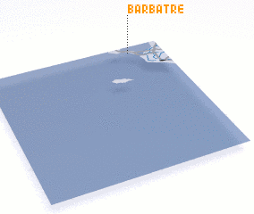 Places with similar names to Barbâtre, France ::
Disclaimer :: Information on this page comes without warranty of any kind |
||
|
Where is Barbâtre? Elevation and coordinates ::
Latitude (lat): 46°57'0"N Longitude (lon): 2°11'0"W
Elevation (approx.): 4m (map arrows pan, magnifying glasses zoom) |
||
|
Visiting Barbâtre? Hotel/Accommodation ::
Book a hotel in Barbâtre Travel Guide ::
Buy a travel guide for France rental cars ::
car rental offers GPS waypoint ::
download a GPX waypoint (PoI) of Barbâtre for your GPS receiver
|
||