|
search place name
|
||
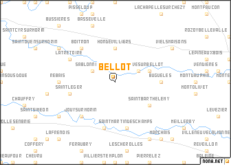
Bellot (Île-de-France, France)Bellot is a town in the Île-de-France region of France. An overview map of the region around Bellot is displayed below.
regional and 3d topo map of Bellot, France ::
Bellot airports ::
The nearest airport is CDG - Paris Charles De Gaulle, located 59.0 km west of Bellot.
Other airports nearby include LBG - Paris Le Bourget (65.5 km west), ORY - Paris Orly (71.7 km west), CSF - Creil (73.6 km north west), RHE - Reims Champagne (74.1 km north east), Nearby towns ::
Villeneuve-sur-Bellot (3.1km north east) //
Sablonnières (3.1km north west) //
Hondevilliers (5.6km north) //
Verdelot (4.1km north east) //
Saint-Barthélemy (5.2km south east) //
Buguélès (4.9km east) //
Saint-Martin-des-Champs (7.5km south) //
La Ferté-Gaucher (7.5km south) //
Saint-Léger (5.2km west) //
Boitron (6.7km north west) //
Jouy-sur-Morin (6.7km south west) //
La Trétoire (6.1km north west) //
[all distances 'as the bird flies' and approximate] 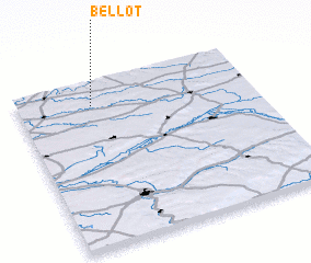 Places with similar names to Bellot, France ::
Disclaimer :: Information on this page comes without warranty of any kind |
||
|
Where is Bellot? Elevation and coordinates ::
Latitude (lat): 48°51'0"N Longitude (lon): 3°19'0"E
Elevation (approx.): 165m (map arrows pan, magnifying glasses zoom) |
||
|
Visiting Bellot? Hotel/Accommodation ::
Book a hotel in Bellot Travel Guide ::
Buy a travel guide for France rental cars ::
car rental offers GPS waypoint ::
download a GPX waypoint (PoI) of Bellot for your GPS receiver
|
||