|
search place name
|
||
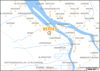
Bernes (Aquitaine, France)Bernes is a town in the Aquitaine region of France. An overview map of the region around Bernes is displayed below.
regional and 3d topo map of Bernes, France ::
Bernes airports ::
The nearest airport is BOD - Bordeaux Merignac, located 20.6 km south of Bernes.
Other airports nearby include XAC - Arcachon La Teste De Buch (59.5 km south west), RYN - Royan Medis (75.2 km north), CNG - Cognac Chateaubernard (76.8 km north), EGC - Bergerac Roumaniere (91.7 km east), Nearby towns ::
Macau (1.9km north) //
Labarde (2.3km north west) //
Ludon-Médoc (2.3km south east) //
La Prade (3.1km north west) //
Le Port (3.6km north) //
Le Marchand (2.6km east) //
Le Pian-Médoc (3.9km south) //
Jean Faure (3.2km north west) //
Saint-Vincent (3.2km north east) //
Port de Macau (3.2km north east) //
Cantenac (4.5km north west) //
Port Lopès (4.6km north east) //
La Reuille (5.8km north) //
Le Rigalet (6.5km north) //
Mirambeau (5.0km north east) //
Matheu (5.4km north west) //
Parempuyre (6.1km south east) //
Bayon (6.1km north east) //
Issan (5.6km north west) //
Pachan (5.0km east) //
Arsac (5.2km west) //
Roque-de-Thau (7.4km north) //
Gauriac (7.4km north) //
Le Marquis (5.2km east) //
Ragouil (5.8km south east) //
Despartins (5.7km south east) //
Francicot (7.6km north) //
Margaux (6.8km north west) //
Saint-Seurin-de-Bourg (6.8km north east) //
[all distances 'as the bird flies' and approximate]  Places with similar names to Bernes, France ::
Disclaimer :: Information on this page comes without warranty of any kind |
||
|
Where is Bernes? Elevation and coordinates ::
Latitude (lat): 45°0'0"N Longitude (lon): 0°37'0"W
Elevation (approx.): 8m (map arrows pan, magnifying glasses zoom) |
||
|
Visiting Bernes? Hotel/Accommodation ::
Book a hotel in Bernes Travel Guide ::
Buy a travel guide for France rental cars ::
car rental offers GPS waypoint ::
download a GPX waypoint (PoI) of Bernes for your GPS receiver
|
||