|
search place name
|
||
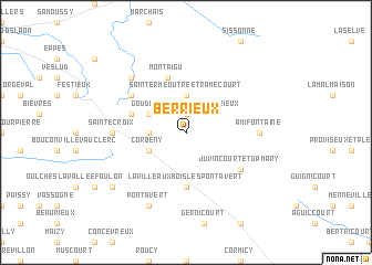
Berrieux (Picardie, France)Berrieux is a town in the Picardie region of France. An overview map of the region around Berrieux is displayed below.
regional and 3d topo map of Berrieux, France ::
Berrieux airports ::
The nearest airport is RHE - Reims Champagne, located 24.1 km south east of Berrieux.
Other airports nearby include CSF - Creil (100.0 km west), CDG - Paris Charles De Gaulle (108.2 km south west), CRL - Charleroi Brussels South (116.9 km north), LBG - Paris Le Bourget (117.4 km south west), Nearby towns ::
Goudelancourt-lés-Berrieux (1.9km north) //
Aizelles (2.4km west) //
Saint-Erme-Outre-et-Ramecourt (3.7km north) //
Corbeny (3.0km south west) //
Saint-Thomas (3.0km north west) //
La Ville-aux-Bois-lès-Pontavert (5.6km south) //
Aubigny-en-Laonnois (4.1km north west) //
Montaigu (5.7km north) //
Juvincourt-et-Damary (5.2km south east) //
Courtrizy-et-Fussigny (5.2km north west) //
Amifontaine (4.8km east) //
Sainte-Croix (4.8km west) //
Mauregny-en-Haye (6.6km north west) //
Pontavert (7.8km south) //
Craonne (7.4km south west) //
[all distances 'as the bird flies' and approximate]  Places with similar names to Berrieux, France ::
Disclaimer :: Information on this page comes without warranty of any kind |
||
|
Where is Berrieux? Elevation and coordinates ::
Latitude (lat): 49°29'0"N Longitude (lon): 3°51'0"E
Elevation (approx.): 90m (map arrows pan, magnifying glasses zoom) |
||
|
Visiting Berrieux? Hotel/Accommodation ::
Book a hotel in Berrieux Travel Guide ::
Buy a travel guide for France rental cars ::
car rental offers GPS waypoint ::
download a GPX waypoint (PoI) of Berrieux for your GPS receiver
|
||