|
search place name
|
||
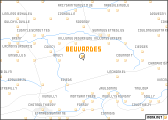
Beuvardes (Picardie, France)Beuvardes is a town in the Picardie region of France. An overview map of the region around Beuvardes is displayed below.
regional and 3d topo map of Beuvardes, France ::
Beuvardes airports ::
The nearest airport is RHE - Reims Champagne, located 44.9 km north east of Beuvardes.
Other airports nearby include CDG - Paris Charles De Gaulle (69.9 km west), CSF - Creil (71.2 km west), LBG - Paris Le Bourget (78.8 km west), ORY - Paris Orly (94.9 km south west), Nearby towns ::
Villeneuve-sur-Fère (3.9km north) //
Brécy (3.6km west) //
Épieds (6.1km south west) //
Bruyères-sur-Fère (5.2km north west) //
Villers-sur-Fère (5.2km north east) //
Fère-en-Tardenois (6.1km north east) //
Saponay (7.4km north) //
Fresnes-en-Tardenois (4.8km east) //
Coincy (5.2km west) //
Chartèves (7.5km south) //
Seringes-et-Nesles (6.6km north east) //
Le Charmel (6.1km south east) //
Jaulgonne (8.3km south east) //
Barzy-sur-Marne (8.9km south east) //
[all distances 'as the bird flies' and approximate] 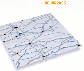
Disclaimer :: Information on this page comes without warranty of any kind |
||
|
Where is Beuvardes? Elevation and coordinates ::
Latitude (lat): 49°9'0"N Longitude (lon): 3°29'0"E
Elevation (approx.): 212m (map arrows pan, magnifying glasses zoom) |
||
|
Visiting Beuvardes? Hotel/Accommodation ::
Book a hotel in Beuvardes Travel Guide ::
Buy a travel guide for France rental cars ::
car rental offers GPS waypoint ::
download a GPX waypoint (PoI) of Beuvardes for your GPS receiver
|
||