|
search place name
|
||
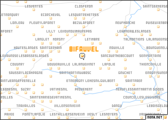
Bifauvel (Haute-Normandie, France)Bifauvel is a town in the Haute-Normandie region of France. An overview map of the region around Bifauvel is displayed below.
regional and 3d topo map of Bifauvel, France ::
Bifauvel airports ::
The nearest airport is URO - Rouen Vallee De Seine, located 33.5 km west of Bifauvel.
Other airports nearby include BVA - Beauvais Tille (36.7 km east), POX - Pontoise Cormeilles En Vexin (40.9 km south east), CSF - Creil (65.3 km east), LBG - Paris Le Bourget (72.6 km south east), Nearby towns ::
La Lande-Vinet (1.9km south) //
Longchamps (2.2km north west) //
Saint-Martin-du-Bosc (3.9km south) //
Le Timbre (3.9km north) //
Heudicourt (3.0km south east) //
Mesnil-sous-Vienne (4.4km north east) //
Maurepas (5.6km north) //
Sancourt (3.6km east) //
La Panne (5.7km north) //
Étrépagny (5.7km south) //
La Folie (4.1km south east) //
Mainneville (4.1km north east) //
La Lande-Perrin (4.1km north west) //
Doudeauville (4.1km south west) //
Morgny (5.2km north west) //
Le Vouroux (6.1km north west) //
Langlée (6.1km north west) //
Le Mesnil-Guilbert (6.1km south east) //
Frileuse (4.8km west) //
Provement (7.4km south) //
Chauvincourt (7.4km south) //
Bézu-la-Forêt (7.4km north) //
Saint-Germain (5.2km west) //
Nojeon-le-Sec (5.2km west) //
Rouville (5.2km east) //
La Curie (6.1km north west) //
Le Thil-en-Vexin (6.1km south west) //
Lilly (7.4km north west) //
Bouchevilliers (7.4km north east) //
[all distances 'as the bird flies' and approximate]  Places with similar names to Bifauvel, France ::
Disclaimer :: Information on this page comes without warranty of any kind |
||
|
Where is Bifauvel? Elevation and coordinates ::
Latitude (lat): 49°21'0"N Longitude (lon): 1°38'0"E
Elevation (approx.): 122m (map arrows pan, magnifying glasses zoom) |
||
|
Visiting Bifauvel? Hotel/Accommodation ::
Book a hotel in Bifauvel Travel Guide ::
Buy a travel guide for France rental cars ::
car rental offers GPS waypoint ::
download a GPX waypoint (PoI) of Bifauvel for your GPS receiver
|
||