|
search place name
|
||
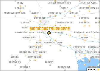
Bignicourt-sur-Marne (Champagne-Ardenne, France)Bignicourt-sur-Marne is a town in the Champagne-Ardenne region of France. An overview map of the region around Bignicourt-sur-Marne is displayed below.
regional and 3d topo map of Bignicourt-sur-Marne, France ::
Bignicourt-sur-Marne airports ::
The nearest airport is QYR - Troyes Barberey, located 59.8 km south west of Bignicourt-sur-Marne.
Other airports nearby include RHE - Reims Champagne (81.1 km north west), EPL - Epinal Mirecourt (114.5 km east), ENC - Nancy Essey (118.8 km east), MZM - Metz Frescaty (119.2 km east), Nearby towns ::
Norrois (1.9km south) //
Cloyes-sur-Marne (2.2km south east) //
Luxémont-et-Villotte (2.2km north east) //
Frignicourt (2.2km north west) //
Goncourt (2.4km east) //
Neuville-sous-Arzillières (3.7km south) //
Villotte (3.1km north east) //
Marolles (3.9km north) //
Blaise-sous-Arzillières (3.1km south west) //
Moncetz-lʼAbbaye (4.4km south east) //
Vauclerc (4.4km north east) //
Arzillières (4.4km south west) //
Henruel (5.2km south west) //
Les Rivières-Henruel (5.2km south west) //
Saint-Rémy-en-Bouzemont-Saint-Genest-et-Isson (6.1km south east) //
Vitry-le-François (6.1km north west) //
Bas Village (6.1km north west) //
Reims-la-Brulée (5.2km north east) //
Matignicourt-Goncourt (4.9km east) //
Écriennes (4.9km east) //
Vitry-en-Perthois (7.4km north) //
Châtelraould-Saint-Louvent (4.9km west) //
Saint-Étienne (7.5km north) //
Saint-Louvent (5.2km west) //
Courdemanges (5.2km west) //
Saint-Chéron (6.7km south west) //
Isle-sur-Marne (6.1km south east) //
Bussy-aux-Bois (7.8km south) //
Blacy (7.4km north west) //
[all distances 'as the bird flies' and approximate] 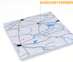 Places with similar names to Bignicourt-sur-Marne, France :: Disclaimer :: Information on this page comes without warranty of any kind |
||
|
Where is Bignicourt-sur-Marne? Elevation and coordinates ::
Latitude (lat): 48°41'0"N Longitude (lon): 4°37'0"E
Elevation (approx.): 104m (map arrows pan, magnifying glasses zoom) |
||
|
Visiting Bignicourt-sur-Marne? Hotel/Accommodation ::
Book a hotel in Bignicourt-sur-Marne Travel Guide ::
Buy a travel guide for France rental cars ::
car rental offers GPS waypoint ::
download a GPX waypoint (PoI) of Bignicourt-sur-Marne for your GPS receiver
|
||