|
search place name
|
||
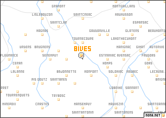
Bivès (Midi-Pyrénées, France)Bivès is a town in the Midi-Pyrénées region of France. An overview map of the region around Bivès is displayed below.
regional and 3d topo map of Bivès, France ::
Bivès airports ::
The nearest airport is AGF - Agen La Garenne, located 42.0 km north west of Bivès.
Other airports nearby include TLS - Toulouse Blagnac (49.6 km south east), LRH - La Rochelle Lherm (55.9 km south east), LDE - Tarbes Lourdes (98.6 km south west), LBI - Albi Le Sequestre (104.6 km east), Nearby towns ::
Cadeilhan (2.7km west) //
Tournecoupe (3.7km north) //
Monfort (3.9km south) //
Avezan (3.9km north) //
Bajonnette (4.6km south west) //
Estramiac (4.0km east) //
Homps (4.4km south east) //
Sainte-Gemme (5.7km south) //
Saint-Léonard (4.4km north west) //
Gaudonville (6.2km north east) //
Sérempuy (5.3km west) //
Saint-Brès (6.9km south west) //
Castéron (6.9km north east) //
Solomiac (6.5km south east) //
Saint-Clar (8.4km north west) //
Labrihe (9.1km south east) //
[all distances 'as the bird flies' and approximate] 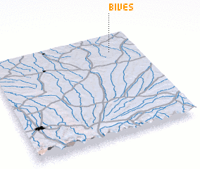 Places with similar names to Bivès, France ::
Disclaimer :: Information on this page comes without warranty of any kind |
||
|
Where is Bivès? Elevation and coordinates ::
Latitude (lat): 43°50'0"N Longitude (lon): 0°49'0"W
Elevation (approx.): 115m (map arrows pan, magnifying glasses zoom) |
||
|
Visiting Bivès? Hotel/Accommodation ::
Book a hotel in Bivès Travel Guide ::
Buy a travel guide for France rental cars ::
car rental offers GPS waypoint ::
download a GPX waypoint (PoI) of Bivès for your GPS receiver
|
||