|
search place name
|
||
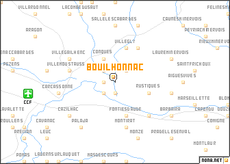
Bouilhonnac (Languedoc-Roussillon, France)Bouilhonnac is a town in the Languedoc-Roussillon region of France. An overview map of the region around Bouilhonnac is displayed below.
regional and 3d topo map of Bouilhonnac, France ::
Bouilhonnac airports ::
The nearest airport is CCF - Carcassonne Salvaza, located 10.5 km west of Bouilhonnac.
Other airports nearby include DCM - Castres Mazamet (37.7 km north), PGF - Perpignan Rivesaltes (65.3 km south east), BZR - Beziers Vias (75.4 km east), LBI - Albi Le Sequestre (79.9 km north), Nearby towns ::
Villedubert (1.4km west) //
Trèbes (1.9km south) //
Berriac (2.3km south west) //
Villalier (2.3km north west) //
Malves (2.3km north east) //
Conques (3.9km north) //
Rustiques (4.5km south east) //
Fontiès-dʼAude (5.7km south) //
Villegly (5.7km north) //
Villarzel-Cabardès (6.2km north east) //
Montirat (7.5km south) //
Villemoustaussou (5.7km west) //
Floure (6.9km south east) //
Villegailhenc (6.5km north west) //
Cazilhac (7.8km south west) //
Palaja (8.4km south west) //
[all distances 'as the bird flies' and approximate] 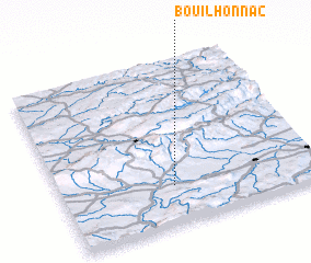 Places with similar names to Bouilhonnac, France :: Disclaimer :: Information on this page comes without warranty of any kind |
||
|
Where is Bouilhonnac? Elevation and coordinates ::
Latitude (lat): 43°14'0"N Longitude (lon): 2°26'0"E
Elevation (approx.): 95m (map arrows pan, magnifying glasses zoom) |
||
|
Visiting Bouilhonnac? Hotel/Accommodation ::
Book a hotel in Bouilhonnac Travel Guide ::
Buy a travel guide for France rental cars ::
car rental offers GPS waypoint ::
download a GPX waypoint (PoI) of Bouilhonnac for your GPS receiver
|
||