|
search place name
|
||
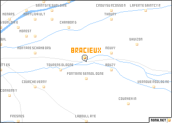
Bracieux (Centre, France)Bracieux is a town in the Centre region of France. An overview map of the region around Bracieux is displayed below.
regional and 3d topo map of Bracieux, France ::
Bracieux airports ::
The nearest airport is ORE - Orleans Bricy, located 51.2 km north of Bracieux.
Other airports nearby include TUF - Tours Val De Loire (63.3 km west), CHR - Chateauroux Deols (77.7 km south), BOU - Bourges (82.7 km south east), LME - Le Mans Arnage (110.4 km north west), Nearby towns ::
Fontaines-en-Sologne (3.7km south) //
Bauzy (4.2km south east) //
Tour-en-Sologne (4.2km south west) //
Neuvy (4.2km north east) //
Chambord (7.8km north) //
[all distances 'as the bird flies' and approximate]  Places with similar names to Bracieux, France ::
// Braschoß (DE)
// Bruscos (PT)
// Būriškės (LT)
// Borzaykasy (RU)
// Borrascoso (CO)
// Borsyksay (KZ)
// Bouresches (FR)
// Bressieux (FR)
// Briscous (FR)
// Brizeaux (FR)
Disclaimer :: Information on this page comes without warranty of any kind |
||
|
Where is Bracieux? Elevation and coordinates ::
Latitude (lat): 47°33'0"N Longitude (lon): 1°33'0"E
Elevation (approx.): 81m (map arrows pan, magnifying glasses zoom) |
||
|
Visiting Bracieux? Hotel/Accommodation ::
Book a hotel in Bracieux Travel Guide ::
Buy a travel guide for France rental cars ::
car rental offers GPS waypoint ::
download a GPX waypoint (PoI) of Bracieux for your GPS receiver
|
||