|
search place name
|
||
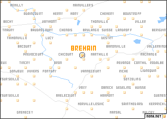
Bréhain (Lorraine, France)Bréhain is a town in the Lorraine region of France. An overview map of the region around Bréhain is displayed below.
regional and 3d topo map of Bréhain, France ::
Bréhain airports ::
The nearest airport is ETZ - Metz Nancy Lorraine, located 21.9 km west of Bréhain.
Other airports nearby include ENC - Nancy Essey (33.4 km south west), MZM - Metz Frescaty (34.1 km north west), SCN - Saarbruecken Saarbrucken (53.6 km north east), EPL - Epinal Mirecourt (74.1 km south west), Nearby towns ::
Villers-sur-Nied (0.0km north) //
Château-Bréhain (2.2km south west) //
Chicourt (2.4km west) //
Marthille (2.4km east) //
Dalhain (3.9km south) //
Vannecourt (3.9km south) //
Arraincourt (5.6km north) //
Achain (3.7km east) //
Holacourt (5.7km north) //
Lesse (5.7km north) //
Brulange (5.7km north) //
Bellange (4.1km south east) //
Oron (4.1km south west) //
Chenois (6.1km north west) //
Destry (5.2km north east) //
Frémery (4.9km west) //
Vaxy (7.4km south) //
Thicourt (7.5km north) //
Hannocourt (5.2km west) //
Lubécourt (7.5km south) //
Gerbécourt (7.5km south) //
Baronville (5.2km east) //
Puttigny (7.5km south) //
Suisse (6.7km north east) //
Lucy (6.1km north west) //
Thonville (7.8km north) //
Fonteny (6.1km south west) //
Obreck (8.3km south east) //
Vatimont (8.9km north west) //
[all distances 'as the bird flies' and approximate]  Places with similar names to Bréhain, France ::
Disclaimer :: Information on this page comes without warranty of any kind |
||
|
Where is Bréhain? Elevation and coordinates ::
Latitude (lat): 48°55'0"N Longitude (lon): 6°32'0"E
Elevation (approx.): 243m (map arrows pan, magnifying glasses zoom) |
||
|
Visiting Bréhain? Hotel/Accommodation ::
Book a hotel in Bréhain Travel Guide ::
Buy a travel guide for France rental cars ::
car rental offers GPS waypoint ::
download a GPX waypoint (PoI) of Bréhain for your GPS receiver
|
||