|
search place name
|
||
Brétignolles-le-Moulin (Pays de la Loire, France)Brétignolles-le-Moulin is a town in the Pays de la Loire region of France. An overview map of the region around Brétignolles-le-Moulin is displayed below.
regional and 3d topo map of Brétignolles-le-Moulin, France ::

Brétignolles-le-Moulin airports ::
The nearest airport is LVA - Laval Entrammes, located 50.8 km south of Brétignolles-le-Moulin.
Other airports nearby include CFR - Caen Carpiquet (78.8 km north), LME - Le Mans Arnage (79.4 km south east), RNS - Rennes St Jacques (99.5 km south west), DOL - Deauville St Gatien (111.9 km north east), Nearby towns ::
Le Housseau (1.2km east) //
Sept-Forges (1.9km north) //
Niort-la-Fontaine (3.7km south) //
Melleray-la-Vallée (2.5km west) //
Lassay (4.4km south east) //
Sainte-Marie-du-Bois (3.7km east) //
Saint-Denis-de-Villenette (5.6km north) //
Rennes-en-Grenouilles (4.1km north east) //
Loré (4.1km north west) //
Chantrigné (6.1km south west) //
Geneslay (6.7km north east) //
La Chapelle-Moche (8.3km north east) //
La Baroche-sous-Lucé (8.3km north west) //
Cigné (7.4km south west) //
Le Horps (8.9km south east) //
[all distances 'as the bird flies' and approximate] 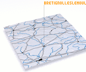 Places with similar names to Brétignolles-le-Moulin, France :: Disclaimer :: Information on this page comes without warranty of any kind |
||
|
Where is Brétignolles-le-Moulin? Elevation and coordinates ::
Latitude (lat): 48°28'0"N Longitude (lon): 0°32'0"W
Elevation (approx.): 174m (map arrows pan, magnifying glasses zoom) |
||
|
Visiting Brétignolles-le-Moulin? Hotel/Accommodation ::
Book a hotel in Brétignolles-le-Moulin Travel Guide ::
Buy a travel guide for France rental cars ::
car rental offers GPS waypoint ::
download a GPX waypoint (PoI) of Brétignolles-le-Moulin for your GPS receiver
|
||