|
search place name
|
||
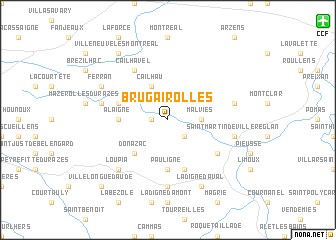
Brugairolles (Languedoc-Roussillon, France)Brugairolles is a town in the Languedoc-Roussillon region of France. An overview map of the region around Brugairolles is displayed below.
regional and 3d topo map of Brugairolles, France ::
Brugairolles airports ::
The nearest airport is CCF - Carcassonne Salvaza, located 16.8 km north east of Brugairolles.
Other airports nearby include DCM - Castres Mazamet (50.1 km north), PGF - Perpignan Rivesaltes (72.2 km south east), LRH - La Rochelle Lherm (80.9 km north west), TLS - Toulouse Blagnac (85.4 km north west), Nearby towns ::
Cambieure (1.4km west) //
Lauraguel (2.3km south east) //
Malviès (2.7km east) //
Cailhau (3.9km north) //
Donazac (4.6km south west) //
Alaigne (4.1km west) //
Pauligne (5.6km south) //
Belvèze-du-Razès (4.5km north west) //
Malras (5.7km south) //
Cailhavel (6.2km north west) //
Gaja-et-Villedieu (5.5km south east) //
Ajac (7.4km south) //
Gramazie (5.7km west) //
Villarzel-du-Razès (5.7km east) //
Saint-Martin-de-Villereglan (5.7km east) //
Loupia (6.9km south west) //
Ferran (6.6km north west) //
La Digne-dʼAval (7.9km south) //
Villeneuve-lès-Montréal (8.5km north west) //
Villelongue-dʼAude (9.2km south west) //
[all distances 'as the bird flies' and approximate]  Places with similar names to Brugairolles, France :: Disclaimer :: Information on this page comes without warranty of any kind |
||
|
Where is Brugairolles? Elevation and coordinates ::
Latitude (lat): 43°7'0"N Longitude (lon): 2°9'0"E
Elevation (approx.): 195m (map arrows pan, magnifying glasses zoom) |
||
|
Visiting Brugairolles? Hotel/Accommodation ::
Book a hotel in Brugairolles Travel Guide ::
Buy a travel guide for France rental cars ::
car rental offers GPS waypoint ::
download a GPX waypoint (PoI) of Brugairolles for your GPS receiver
|
||