|
search place name
|
||
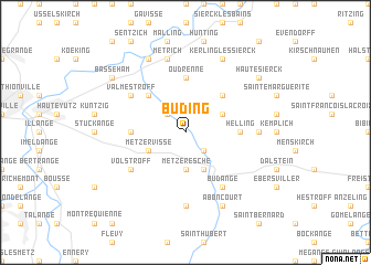
Buding (Lorraine, France)Buding is a town in the Lorraine region of France. An overview map of the region around Buding is displayed below.
regional and 3d topo map of Buding, France ::
Buding airports ::
The nearest airport is MZM - Metz Frescaty, located 32.1 km south west of Buding.
Other airports nearby include LUX - Luxemburg Luxembourg (33.5 km north), ETZ - Metz Nancy Lorraine (39.3 km south), SCN - Saarbruecken Saarbrucken (59.2 km east), ZQF - Trier Fohren (68.1 km north east), Nearby towns ::
Kédange-sur-Canner (2.2km south east) //
Inglange (2.2km north west) //
Metzeresche (3.7km south) //
Hombourg-Budange (3.9km south) //
Budling (3.0km north east) //
Metzervisse (3.0km south west) //
Lemestroff (4.4km north east) //
Elzange (4.4km north west) //
Oudrenne (5.6km north) //
Distroff (3.6km west) //
Helling (3.6km east) //
Budange (6.1km south east) //
Volstroff (5.2km south west) //
Valmestroff (5.2km north west) //
Luttange (7.4km south) //
Veckring (4.8km east) //
Métrich (7.5km north) //
Aboncourt (7.8km south) //
Kerling-lès-Sierck (7.8km north) //
Koenigsmacker (7.8km north) //
Haute-Sierck (7.4km north east) //
Basse-Ham (7.4km north west) //
[all distances 'as the bird flies' and approximate] 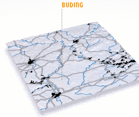 Places with similar names to Buding, France ::
Disclaimer :: Information on this page comes without warranty of any kind |
||
|
Where is Buding? Elevation and coordinates ::
Latitude (lat): 49°20'0"N Longitude (lon): 6°19'0"E
Elevation (approx.): 174m (map arrows pan, magnifying glasses zoom) |
||
|
Visiting Buding? Hotel/Accommodation ::
Book a hotel in Buding Travel Guide ::
Buy a travel guide for France rental cars ::
car rental offers GPS waypoint ::
download a GPX waypoint (PoI) of Buding for your GPS receiver
|
||