|
search place name
|
||
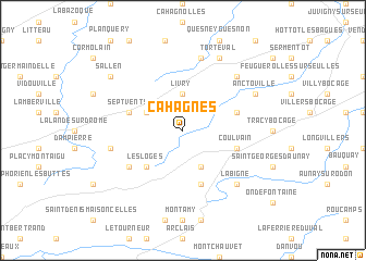
Cahagnes (Basse-Normandie, France)Cahagnes is a town in the Basse-Normandie region of France. An overview map of the region around Cahagnes is displayed below.
regional and 3d topo map of Cahagnes, France ::
Cahagnes airports ::
The nearest airport is CFR - Caen Carpiquet, located 26.0 km north east of Cahagnes.
Other airports nearby include DOL - Deauville St Gatien (74.9 km north east), LEH - Le Havre Octeville (81.0 km north east), CER - Cherbourg Maupertus (82.6 km north west), JER - Jersey (105.4 km west), Nearby towns ::
Livry (3.7km north) //
Caumont-lʼÉventé (3.1km north west) //
Saint-Pierre-du-Fresne (3.9km south) //
Les Loges (4.4km south west) //
Sept-vents (4.1km north west) //
Amayé-sur-Seulles (4.1km north east) //
Jurques (5.7km south) //
Coulvain (4.1km south east) //
La Ferrière-au-Doyen (5.2km south west) //
Parfouru-lʼÉclin (7.5km north) //
Saint-Jean-des-Essartiers (5.2km west) //
La Bigne (6.6km south east) //
Saint-Germain-dʼEctot (6.6km north east) //
Torteval (7.8km north) //
Anctoville (6.1km north east) //
Sallen (7.4km north west) //
[all distances 'as the bird flies' and approximate]  Places with similar names to Cahagnes, France ::
// Cahaignes (FR)
// Khu Quân Sư (VN)
Disclaimer :: Information on this page comes without warranty of any kind |
||
|
Where is Cahagnes? Elevation and coordinates ::
Latitude (lat): 49°4'0"N Longitude (lon): 0°46'0"W
Elevation (approx.): 172m (map arrows pan, magnifying glasses zoom) |
||
|
Visiting Cahagnes? Hotel/Accommodation ::
Book a hotel in Cahagnes Travel Guide ::
Buy a travel guide for France rental cars ::
car rental offers GPS waypoint ::
download a GPX waypoint (PoI) of Cahagnes for your GPS receiver
|
||