|
search place name
|
||
Camou-Cihigue (Aquitaine, France)Camou-Cihigue is a town in the Aquitaine region of France. An overview map of the region around Camou-Cihigue is displayed below.
regional and 3d topo map of Camou-Cihigue, France ::

Camou-Cihigue airports ::
The nearest airport is PUF - Pau Pyrenees, located 48.8 km north east of Camou-Cihigue.
Other airports nearby include BIQ - Biarritz-bayonne Anglet (63.9 km north west), PNA - Pamplona (72.1 km south west), LDE - Tarbes Lourdes (73.0 km east), EAS - San Sebastian (77.1 km west), Nearby towns ::
Alçay-Alçabéhéty-Sunharette (1.9km south) //
Ossas-Suhare (2.3km north east) //
Alos-Sibas-Abense-de-Haut (2.7km east) //
Trois-Villes (3.3km north east) //
Sauguis-Saint-Étienne (3.9km north) //
Lichans-Sunhar (3.3km south east) //
Lacarry-Arhan-Charritte-de-Haut (3.9km south) //
Etchebar (3.9km south) //
Aussurucq (4.6km north west) //
Menditte (5.6km north) //
Tardets-Sorholus (4.1km east) //
Laguinge-Restoue (4.5km south east) //
Licq-Athérey (6.2km south east) //
Haux (5.5km south east) //
Idaux-Mendy (7.5km north) //
Ordiarp (7.9km north) //
[all distances 'as the bird flies' and approximate] 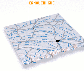 Places with similar names to Camou-Cihigue, France ::
// Kamyzhak (RU)
Disclaimer :: Information on this page comes without warranty of any kind |
||
|
Where is Camou-Cihigue? Elevation and coordinates ::
Latitude (lat): 43°7'0"N Longitude (lon): 0°54'0"W
Elevation (approx.): 246m (map arrows pan, magnifying glasses zoom) |
||
|
Visiting Camou-Cihigue? Hotel/Accommodation ::
Book a hotel in Camou-Cihigue Travel Guide ::
Buy a travel guide for France rental cars ::
car rental offers GPS waypoint ::
download a GPX waypoint (PoI) of Camou-Cihigue for your GPS receiver
|
||