|
search place name
|
||
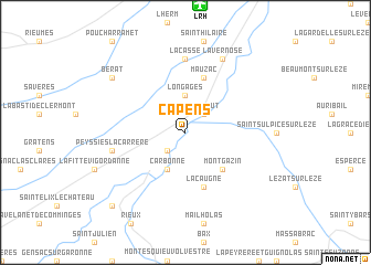
Capens (Midi-Pyrénées, France)Capens is a town in the Midi-Pyrénées region of France. An overview map of the region around Capens is displayed below.
regional and 3d topo map of Capens, France ::
Capens airports ::
The nearest airport is LRH - La Rochelle Lherm, located 12.9 km north of Capens.
Other airports nearby include TLS - Toulouse Blagnac (34.1 km north), CCF - Carcassonne Salvaza (86.7 km east), DCM - Castres Mazamet (87.7 km east), LBI - Albi Le Sequestre (94.9 km north east), Nearby towns ::
Marquefave (2.3km south west) //
Noé (2.3km north east) //
Montaut (2.3km north east) //
Longages (3.7km north) //
Carbonne (3.9km south) //
Montgazin (4.6km south east) //
Lacaugne (5.7km south) //
Mauzac (5.7km north) //
Lacasse (7.4km north) //
Peyssies-la-Carrère (5.7km west) //
Lavernose (7.9km north) //
Le Fauga (7.9km north) //
Bérat (7.7km north west) //
Salles-sur-Garonne (9.2km south west) //
[all distances 'as the bird flies' and approximate] 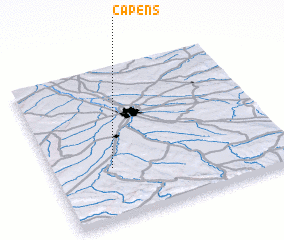 Places with similar names to Capens, France ::
Disclaimer :: Information on this page comes without warranty of any kind |
||
|
Where is Capens? Elevation and coordinates ::
Latitude (lat): 43°20'0"N Longitude (lon): 1°15'0"E
Elevation (approx.): 200m (map arrows pan, magnifying glasses zoom) |
||
|
Visiting Capens? Hotel/Accommodation ::
Book a hotel in Capens Travel Guide ::
Buy a travel guide for France rental cars ::
car rental offers GPS waypoint ::
download a GPX waypoint (PoI) of Capens for your GPS receiver
|
||