|
search place name
|
||
Chaignes (Haute-Normandie, France)Chaignes is a town in the Haute-Normandie region of France. An overview map of the region around Chaignes is displayed below.
regional and 3d topo map of Chaignes, France ::

Chaignes airports ::
The nearest airport is POX - Pontoise Cormeilles En Vexin, located 44.1 km east of Chaignes.
Other airports nearby include URO - Rouen Vallee De Seine (45.5 km north west), TNF - Toussous-le-noble Toussus Le Noble (56.4 km south east), BVA - Beauvais Tille (68.6 km north east), LBG - Paris Le Bourget (72.7 km east), Nearby towns ::
Gournay (1.9km north) //
Douains (2.2km north west) //
Le Buisson (2.2km north east) //
Villegats (2.2km south east) //
Chaufour-lès-Bonnières (2.4km east) //
La Saussaye (3.1km north east) //
Maulu (3.9km north) //
Le But (3.9km north) //
Aigleville (3.1km south west) //
Longuemare (3.1km south east) //
Cravent (3.1km south east) //
Saint-Chéron (3.9km south) //
Blaru (4.4km north east) //
Hécourt (4.4km south west) //
Le Val-Comtat (4.4km south east) //
Breuilpont (5.7km south) //
Chêne-Godon (5.2km north east) //
La Heunière (6.1km north west) //
Heurgeville (6.1km south east) //
Gadencourt (5.2km south west) //
Bizy (7.4km north) //
Pacy-sur-Eure (4.9km west) //
Chanu (7.5km south) //
Fains (5.2km west) //
Lommoye (5.2km east) //
Saint-Vincent-des-Bois (6.6km north west) //
Merey (6.6km south west) //
Saint-Illiers-le-Bois (6.6km south east) //
Vernon (7.8km north) //
[all distances 'as the bird flies' and approximate] 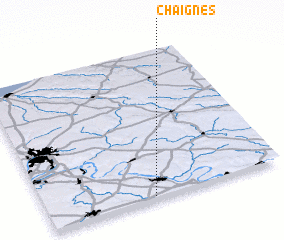 Places with similar names to Chaignes, France ::
Disclaimer :: Information on this page comes without warranty of any kind |
||
|
Where is Chaignes? Elevation and coordinates ::
Latitude (lat): 49°1'0"N Longitude (lon): 1°27'0"E
Elevation (approx.): 141m (map arrows pan, magnifying glasses zoom) |
||
|
Visiting Chaignes? Hotel/Accommodation ::
Book a hotel in Chaignes Travel Guide ::
Buy a travel guide for France rental cars ::
car rental offers GPS waypoint ::
download a GPX waypoint (PoI) of Chaignes for your GPS receiver
|
||