|
search place name
|
||
Chalmessin (Champagne-Ardenne, France)Chalmessin is a town in the Champagne-Ardenne region of France. An overview map of the region around Chalmessin is displayed below.
regional and 3d topo map of Chalmessin, France ::

Chalmessin airports ::
The nearest airport is DIJ - Dijon Longvic, located 48.0 km south of Chalmessin.
Other airports nearby include DLE - Dole Tavaux (78.4 km south), XCD - Chalon Champforgeuil (99.0 km south), EPL - Epinal Mirecourt (102.1 km north east), QYR - Troyes Barberey (104.5 km north west), Nearby towns ::
Lamargelle-aux-Bois (1.2km west) //
Villemervry (1.9km south) //
Vivey (3.7km north) //
Praslay (4.5km north east) //
Villemoron (4.5km south east) //
Grancey-le-Château (4.5km south west) //
Musseau (3.7km east) //
Mouilleron (3.7km east) //
Cussey-les-Forges (5.7km south) //
Poinsenot (5.3km west) //
Neuvelle-lès-Grancey (5.3km west) //
Le Courroy (6.7km north west) //
Santenoge (6.2km north west) //
Courlon (7.5km south west) //
[all distances 'as the bird flies' and approximate] 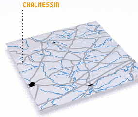 Places with similar names to Chalmessin, France ::
// Chalmaison (FR)
Disclaimer :: Information on this page comes without warranty of any kind |
||
|
Where is Chalmessin? Elevation and coordinates ::
Latitude (lat): 47°42'0"N Longitude (lon): 5°4'0"E
Elevation (approx.): 402m (map arrows pan, magnifying glasses zoom) |
||
|
Visiting Chalmessin? Hotel/Accommodation ::
Book a hotel in Chalmessin Travel Guide ::
Buy a travel guide for France rental cars ::
car rental offers GPS waypoint ::
download a GPX waypoint (PoI) of Chalmessin for your GPS receiver
|
||