|
search place name
|
||
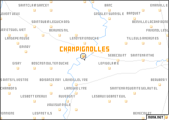
Champignolles (Haute-Normandie, France)Champignolles is a town in the Haute-Normandie region of France. An overview map of the region around Champignolles is displayed below.
regional and 3d topo map of Champignolles, France ::
Champignolles airports ::
The nearest airport is URO - Rouen Vallee De Seine, located 55.1 km north east of Champignolles.
Other airports nearby include DOL - Deauville St Gatien (62.9 km north west), LEH - Le Havre Octeville (80.1 km north west), CFR - Caen Carpiquet (91.8 km west), POX - Pontoise Cormeilles En Vexin (94.3 km east), Nearby towns ::
Ajou (2.2km north east) //
Le Noyer-en-Ouche (3.7km north) //
La Ferrière-sur-Risle (3.1km north east) //
La Houssaye (3.1km north east) //
Thevray (3.1km north west) //
La Vieille-Lyre (5.7km south) //
Le Fidelaire (4.1km south east) //
Gouttières (5.7km north) //
Sébécourt (4.9km east) //
Bosc-Renoult-en-Ouche (5.2km west) //
La Neuve-Lyre (7.5km south) //
Beaumesnil (6.6km north west) //
Bois-Anzeray (7.4km south west) //
Saint-Aubin-le-Guichard (8.9km north west) //
Bois-Normand-près-Lyre (8.9km south west) //
[all distances 'as the bird flies' and approximate]  Places with similar names to Champignolles, France ::
Disclaimer :: Information on this page comes without warranty of any kind |
||
|
Where is Champignolles? Elevation and coordinates ::
Latitude (lat): 48°58'0"N Longitude (lon): 0°46'0"W
Elevation (approx.): 131m (map arrows pan, magnifying glasses zoom) |
||
|
Visiting Champignolles? Hotel/Accommodation ::
Book a hotel in Champignolles Travel Guide ::
Buy a travel guide for France rental cars ::
car rental offers GPS waypoint ::
download a GPX waypoint (PoI) of Champignolles for your GPS receiver
|
||