|
search place name
|
||
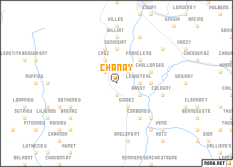
Chanay (Rhône-Alpes, France)Chanay is a town in the Rhône-Alpes region of France. An overview map of the region around Chanay is displayed below.
regional and 3d topo map of Chanay, France ::
Chanay airports ::
The nearest airport is NCY - Annecy Meythet, located 25.7 km east of Chanay.
Other airports nearby include GVA - Geneva Cointrin (36.5 km north east), CMF - Chambery Aix Les Bains (40.9 km south), QNJ - Annemasse (43.2 km north east), XBK - Bourg Ceyzeriat (44.1 km north west), Nearby towns ::
Puthier (1.9km south) //
Lʼhôpital (2.3km north west) //
Surjoux (2.3km north east) //
Les Métral (2.6km east) //
Craz (3.9km north) //
Gignez (3.9km south) //
Bassy (3.2km south east) //
Franclens (4.5km north east) //
Génissiat (5.6km north) //
Usinens (3.9km east) //
Injoux (5.7km north) //
Challonges (4.3km north east) //
Seyssel (6.1km south east) //
Corbonod (6.1km south east) //
Billiat (7.4km north) //
Cologny (5.5km east) //
Seyssel (6.8km south east) //
Sothonod (6.3km south west) //
Saint-Germain-sur-Rhône (7.8km north) //
Brénaz (7.6km south west) //
Chêne-en-Semine (7.6km north east) //
Château-Fort (8.4km south east) //
Lochieu (9.0km south west) //
Vens (9.0km south east) //
[all distances 'as the bird flies' and approximate] 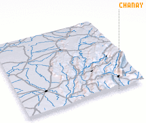 Places with similar names to Chanay, France ::
Disclaimer :: Information on this page comes without warranty of any kind |
||
|
Where is Chanay? Elevation and coordinates ::
Latitude (lat): 46°0'0"N Longitude (lon): 5°47'0"E
Elevation (approx.): 450m (map arrows pan, magnifying glasses zoom) |
||
|
Visiting Chanay? Hotel/Accommodation ::
Book a hotel in Chanay Travel Guide ::
Buy a travel guide for France rental cars ::
car rental offers GPS waypoint ::
download a GPX waypoint (PoI) of Chanay for your GPS receiver
|
||