|
search place name
|
||
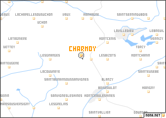
Charmoy (Bourgogne, France)Charmoy is a town in the Bourgogne region of France. An overview map of the region around Charmoy is displayed below.
regional and 3d topo map of Charmoy, France ::
Charmoy airports ::
The nearest airport is XCD - Chalon Champforgeuil, located 37.9 km east of Charmoy.
Other airports nearby include QNX - Macon Charnay (61.8 km south east), XMU - Moulins Montbeugny (73.6 km west), RNE - Roanne Renaison (81.0 km south), DIJ - Dijon Longvic (81.5 km north east), Nearby towns ::
Saint-Nizier (1.3km east) //
Charmoy-la-Ville (1.9km north) //
Les Bizots (3.8km east) //
Saint-Berain-sous-Sanvignes (6.1km south west) //
Montcenis (5.3km north east) //
Les Granges (5.1km west) //
Blanzy (6.7km south east) //
La Coudraye (6.3km south west) //
Bois-Roulot (8.3km south east) //
[all distances 'as the bird flies' and approximate] 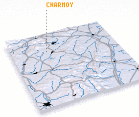 Places with similar names to Charmoy, France ::
Disclaimer :: Information on this page comes without warranty of any kind |
||
|
Where is Charmoy? Elevation and coordinates ::
Latitude (lat): 46°45'0"N Longitude (lon): 4°20'0"E
Elevation (approx.): 342m (map arrows pan, magnifying glasses zoom) |
||
|
Visiting Charmoy? Hotel/Accommodation ::
Book a hotel in Charmoy Travel Guide ::
Buy a travel guide for France rental cars ::
car rental offers GPS waypoint ::
download a GPX waypoint (PoI) of Charmoy for your GPS receiver
|
||