|
search place name
|
||
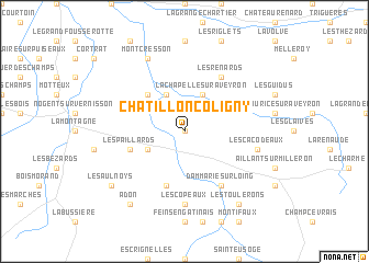
Châtillon-Coligny (Centre, France)Châtillon-Coligny is a town in the Centre region of France. An overview map of the region around Châtillon-Coligny is displayed below.
regional and 3d topo map of Châtillon-Coligny, France ::
Châtillon-Coligny airports ::
The nearest airport is AUF - Auxerre Branches, located 48.5 km east of Châtillon-Coligny.
Other airports nearby include ORE - Orleans Bricy (83.2 km west), BOU - Bourges (93.5 km south west), NVS - Nevers Fourchambault (94.5 km south), QYR - Troyes Barberey (102.5 km north east), Nearby towns ::
Les Tranchants (0.0km north) //
Sainte-Geneviève-des-Bois (3.1km south west) //
Les Cerfs (3.9km north) //
La Chapelle-sur-Aveyron (3.9km north) //
Le Vieux Renard (4.5km north west) //
Montbouy (4.5km north west) //
Les Paillards (4.2km south west) //
Les Réaux (5.7km south) //
Dammarie-sur-Loing (6.1km south east) //
Les Guénins (6.1km north east) //
Les Renards (6.1km north east) //
Les Copeaux (7.4km south) //
Les Cacodeaux (5.3km east) //
Montcresson (7.8km north) //
Les Toulerons (8.3km south east) //
Adon (8.3km south west) //
Les Aulnoys (7.5km south west) //
[all distances 'as the bird flies' and approximate] 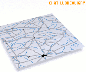 Places with similar names to Châtillon-Coligny, France :: Disclaimer :: Information on this page comes without warranty of any kind |
||
|
Where is Châtillon-Coligny? Elevation and coordinates ::
Latitude (lat): 47°50'0"N Longitude (lon): 2°51'0"E
Elevation (approx.): 133m (map arrows pan, magnifying glasses zoom) |
||
|
Visiting Châtillon-Coligny? Hotel/Accommodation ::
Book a hotel in Châtillon-Coligny Travel Guide ::
Buy a travel guide for France rental cars ::
car rental offers GPS waypoint ::
download a GPX waypoint (PoI) of Châtillon-Coligny for your GPS receiver
|
||