|
search place name
|
||
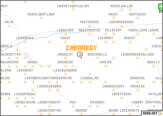
Chennegy (Champagne-Ardenne, France)Chennegy is a town in the Champagne-Ardenne region of France. An overview map of the region around Chennegy is displayed below.
regional and 3d topo map of Chennegy, France ::
Chennegy airports ::
The nearest airport is QYR - Troyes Barberey, located 17.0 km north east of Chennegy.
Other airports nearby include AUF - Auxerre Branches (48.5 km south west), RHE - Reims Champagne (122.5 km north), ORY - Paris Orly (123.9 km north west), CDG - Paris Charles De Gaulle (130.5 km north west), Nearby towns ::
Le Valdreux (2.2km south west) //
Bercenelle (2.5km east) //
Bercenay-en-Othe (2.5km east) //
Vaugeley (2.5km west) //
Surançon (3.1km south west) //
Le Bas Champcharme (3.9km south) //
Thuisy (4.5km north west) //
Les Vaucouard (4.5km south west) //
Maraye-en-Othe (5.6km south) //
Le Haut Champcharme (5.7km south) //
La Belle-Fayte (5.7km south) //
Les Boulins (5.7km south) //
Concise (4.1km south east) //
Bucey-en-Othe (5.7km north) //
Le Chaast (5.2km north east) //
Le Boutoir (6.1km north west) //
Estissac (6.1km north west) //
Vauchassis (4.9km east) //
Fontvannes (7.5km north) //
Villemoiron-en-Othe (5.3km west) //
La Perrière (6.7km south east) //
Saint-Mards-en-Othe (6.7km south west) //
Messon (6.7km north east) //
Errey (6.2km north east) //
Bourg-de-Partie (6.2km north west) //
Neuville-sur-Vanne (6.2km north west) //
La Belle Épine (7.4km south west) //
La Mivoye (8.3km south west) //
Nogent-en-Othe (8.3km south west) //
[all distances 'as the bird flies' and approximate] 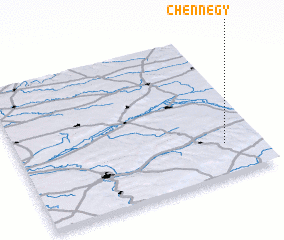 Places with similar names to Chennegy, France ::
Disclaimer :: Information on this page comes without warranty of any kind |
||
|
Where is Chennegy? Elevation and coordinates ::
Latitude (lat): 48°13'0"N Longitude (lon): 3°51'0"E
Elevation (approx.): 199m (map arrows pan, magnifying glasses zoom) |
||
|
Visiting Chennegy? Hotel/Accommodation ::
Book a hotel in Chennegy Travel Guide ::
Buy a travel guide for France rental cars ::
car rental offers GPS waypoint ::
download a GPX waypoint (PoI) of Chennegy for your GPS receiver
|
||