|
search place name
|
||
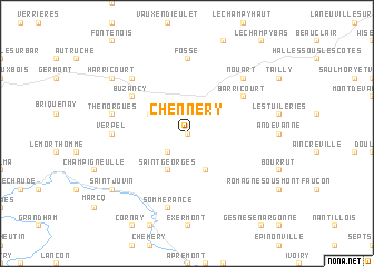
Chennery (Champagne-Ardenne, France)Chennery is a town in the Champagne-Ardenne region of France. An overview map of the region around Chennery is displayed below.
regional and 3d topo map of Chennery, France ::
Chennery airports ::
The nearest airport is RHE - Reims Champagne, located 69.5 km west of Chennery.
Other airports nearby include MZM - Metz Frescaty (89.4 km east), LUX - Luxemburg Luxembourg (91.8 km east), ETZ - Metz Nancy Lorraine (101.6 km south east), ENC - Nancy Essey (118.3 km south east), Nearby towns ::
Landreville (0.0km north) //
Bayonville-et-Chennery (1.9km north) //
Imécourt (2.2km south west) //
Saint-Georges (3.9km south) //
Landres-et-Saint-Georges (3.9km south) //
Sivry-lès-Buzancy (3.0km north west) //
Rémonville (3.0km north east) //
Barricourt (5.2km north east) //
Buzancy (5.2km north west) //
Verpel (4.8km west) //
Fossé (7.4km north) //
Sommerance (7.5km south) //
Thénorgues (5.2km west) //
Nouart (6.6km north east) //
Bar-lès-Buzancy (6.6km north west) //
Saint-Juvin (7.4km south west) //
Harricourt (7.4km north west) //
[all distances 'as the bird flies' and approximate] 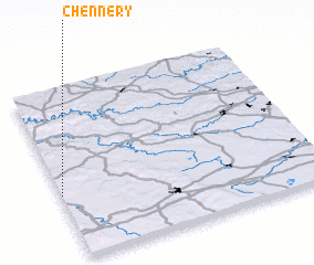 Places with similar names to Chennery, France ::
Disclaimer :: Information on this page comes without warranty of any kind |
||
|
Where is Chennery? Elevation and coordinates ::
Latitude (lat): 49°23'0"N Longitude (lon): 5°0'0"E
Elevation (approx.): 235m (map arrows pan, magnifying glasses zoom) |
||
|
Visiting Chennery? Hotel/Accommodation ::
Book a hotel in Chennery Travel Guide ::
Buy a travel guide for France rental cars ::
car rental offers GPS waypoint ::
download a GPX waypoint (PoI) of Chennery for your GPS receiver
|
||