|
search place name
|
||
Chevincourt (Picardie, France)Chevincourt is a town in the Picardie region of France. An overview map of the region around Chevincourt is displayed below.
regional and 3d topo map of Chevincourt, France ::

Chevincourt airports ::
The nearest airport is CSF - Creil, located 36.4 km south west of Chevincourt.
Other airports nearby include BVA - Beauvais Tille (53.7 km west), CDG - Paris Charles De Gaulle (58.4 km south), LBG - Paris Le Bourget (66.1 km south west), POX - Pontoise Cormeilles En Vexin (74.0 km south west), Nearby towns ::
Mélicocq (0.0km north) //
Machemont (1.2km east) //
Marest-sur-Matz (2.2km north west) //
Thourotte (3.0km south east) //
Longueil-Annel (3.9km south) //
Giraumont (4.4km south west) //
Coudun (4.4km south west) //
Élincourt-Sainte-Marguerite (4.4km north west) //
Cambronne-lès-Ribécourt (3.6km east) //
Vandélicourt (3.6km west) //
Bienville (5.7km south) //
Clairoix (5.7km south) //
Janville (5.7km south) //
Montmacq (4.1km south east) //
Villers-sur-Coudun (4.1km south west) //
Le Plessis-Brion (5.2km south east) //
Vignemont (4.8km west) //
Ribécourt (5.2km east) //
Margny-sur-Matz (5.2km west) //
Cannectancourt (6.6km north east) //
Mareuil-la-Motte (6.6km north west) //
Thiescourt (7.8km north) //
Choisy-au-Bac (7.8km south) //
Gury (7.8km north) //
Margny-lès-Compiègne (7.8km south) //
Évricourt (8.2km north east) //
[all distances 'as the bird flies' and approximate] 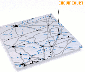 Places with similar names to Chevincourt, France ::
// Chauvoncourt (FR)
// Chauvincourt (FR)
Disclaimer :: Information on this page comes without warranty of any kind |
||
|
Where is Chevincourt? Elevation and coordinates ::
Latitude (lat): 49°30'0"N Longitude (lon): 2°51'0"E
Elevation (approx.): 46m (map arrows pan, magnifying glasses zoom) |
||
|
Visiting Chevincourt? Hotel/Accommodation ::
Book a hotel in Chevincourt Travel Guide ::
Buy a travel guide for France rental cars ::
car rental offers GPS waypoint ::
download a GPX waypoint (PoI) of Chevincourt for your GPS receiver
|
||