|
search place name
|
||
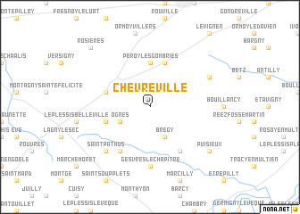
Chèvreville (Picardie, France)Chèvreville is a town in the Picardie region of France. An overview map of the region around Chèvreville is displayed below.
regional and 3d topo map of Chèvreville, France ::
Chèvreville airports ::
The nearest airport is CDG - Paris Charles De Gaulle, located 24.8 km south west of Chèvreville.
Other airports nearby include CSF - Creil (28.5 km north west), LBG - Paris Le Bourget (34.1 km south west), ORY - Paris Orly (56.5 km south west), POX - Pontoise Cormeilles En Vexin (59.1 km west), Nearby towns ::
Ognes (3.1km south west) //
Brégy (3.9km south) //
Péroy-les-Gombries (5.6km north) //
Nanteuil-le-Haudouin (4.1km north west) //
Boissy-Fresnoy (5.7km north) //
Silly-le-Long (4.1km south west) //
Douy-la-Ramée (6.1km south east) //
Oissery (6.1km south west) //
Forfry (7.4km south) //
Gesvres-le-Chapitre (7.4km south) //
Saint-Pathus (6.6km south west) //
Villers-Saint-Genest (6.1km north east) //
Puisieux (7.4km south east) //
Rosières (8.9km north west) //
[all distances 'as the bird flies' and approximate]  Places with similar names to Chèvreville, France ::
// Chefe Rafael (MZ)
// Chèvreville (FR)
Disclaimer :: Information on this page comes without warranty of any kind |
||
|
Where is Chèvreville? Elevation and coordinates ::
Latitude (lat): 49°7'0"N Longitude (lon): 2°51'0"E
Elevation (approx.): 123m (map arrows pan, magnifying glasses zoom) |
||
|
Visiting Chèvreville? Hotel/Accommodation ::
Book a hotel in Chèvreville Travel Guide ::
Buy a travel guide for France rental cars ::
car rental offers GPS waypoint ::
download a GPX waypoint (PoI) of Chèvreville for your GPS receiver
|
||