|
search place name
|
||
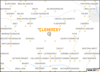
Clémencey (Bourgogne, France)Clémencey is a town in the Bourgogne region of France. An overview map of the region around Clémencey is displayed below.
regional and 3d topo map of Clémencey, France ::
Clémencey airports ::
The nearest airport is DIJ - Dijon Longvic, located 15.8 km east of Clémencey.
Other airports nearby include XCD - Chalon Champforgeuil (47.4 km south), DLE - Dole Tavaux (47.5 km south east), QNX - Macon Charnay (106.4 km south), XBK - Bourg Ceyzeriat (120.7 km south), Nearby towns ::
Quémigny-Poisot (2.2km south west) //
Chamboeuf (2.2km south east) //
Urcy (3.1km north west) //
Flavignerot (4.5km north east) //
Ternant (6.1km south west) //
Curley (6.1km south east) //
LʼÉtang-Vergy (7.4km south) //
Gergueil (5.4km west) //
Reulle-Vergy (7.5km south) //
Gevrey-Chambertin (5.4km east) //
Corcelles-les-Monts (6.7km north east) //
Arcey (6.2km north west) //
Bévy (7.8km south) //
Fleurey-sur-Ouche (7.8km north) //
Pont-de-Pany (7.5km north west) //
Chambolle-Musigny (9.0km south east) //
[all distances 'as the bird flies' and approximate]  Places with similar names to Clémencey, France ::
// Clemenceau (US)
// Gallmünz (DE)
// Gollmenz (DE)
// Kallmünz (DE)
// Kehlmünz (DE)
// Kellmünz (DE)
// Clemons (US)
// Colamanci (IT)
// Collemancio (IT)
// Collemincio (IT)
Disclaimer :: Information on this page comes without warranty of any kind |
||
|
Where is Clémencey? Elevation and coordinates ::
Latitude (lat): 47°15'0"N Longitude (lon): 4°53'0"E
Elevation (approx.): 457m (map arrows pan, magnifying glasses zoom) |
||
|
Visiting Clémencey? Hotel/Accommodation ::
Book a hotel in Clémencey Travel Guide ::
Buy a travel guide for France rental cars ::
car rental offers GPS waypoint ::
download a GPX waypoint (PoI) of Clémencey for your GPS receiver
|
||