|
search place name
|
||
Copponex (Rhône-Alpes, France)Copponex is a town in the Rhône-Alpes region of France. An overview map of the region around Copponex is displayed below.
regional and 3d topo map of Copponex, France ::

Copponex airports ::
The nearest airport is NCY - Annecy Meythet, located 13.7 km south of Copponex.
Other airports nearby include GVA - Geneva Cointrin (21.2 km north), QNJ - Annemasse (22.2 km north east), CMF - Chambery Aix Les Bains (48.0 km south), XBK - Bourg Ceyzeriat (62.2 km west), Nearby towns ::
Andilly (0.0km north) //
Cercier (1.9km south) //
Saint-Blaise (2.3km north east) //
Cernex (2.3km north west) //
Avregny (3.9km south) //
Chavannaz (3.9km west) //
Présilly (5.7km north) //
Cruseilles (4.3km south east) //
Vers (6.1km north west) //
Rossy (7.5km south) //
Feigères (7.5km north) //
Marlioz (5.5km west) //
Choisy (7.5km south) //
Allonzier-la-Caille (6.8km south east) //
Beaumont (6.8km north east) //
Neydens (7.8km north) //
Viry (7.8km north) //
Villy-le-Pelloux (7.6km south east) //
Sallenôves (7.6km south west) //
Mésigny (9.0km south west) //
Chênex (9.0km north west) //
[all distances 'as the bird flies' and approximate] 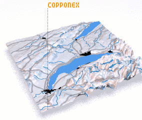 Places with similar names to Copponex, France ::
Disclaimer :: Information on this page comes without warranty of any kind |
||
|
Where is Copponex? Elevation and coordinates ::
Latitude (lat): 46°3'0"N Longitude (lon): 6°4'0"E
Elevation (approx.): 573m (map arrows pan, magnifying glasses zoom) |
||
|
Visiting Copponex? Hotel/Accommodation ::
Book a hotel in Copponex Travel Guide ::
Buy a travel guide for France rental cars ::
car rental offers GPS waypoint ::
download a GPX waypoint (PoI) of Copponex for your GPS receiver
|
||